Driving from the Texas Hill Country out to West Texas is an experience in itself. Texas is big in a way that doesn’t fully make sense until you’re in it. It honestly reminds me of Canadian provinces in terms of distance. You can drive all day and still be in the same state.
While driving down the interstate the hills flattened, the trees spaced out, and eventually disappeared. The landscape opened up in a big way. Long straight roads, barely any turns, and a horizon that just kept going. It felt wide and exposed, but also kind of peaceful in its simplicity.
Then, just when it starts to feel like it will stay that way forever, West Texas decides to switch things up. Or maybe it’s because the speed limit is suddenly 80 mph and everything out here is moving at full throttle, including the scenery. That’s my completely unscientific explanation.
As we got closer to Fort Davis, the ground started to roll again. Subtle at first, then suddenly not subtle at all. Massive rock formations rise out of the desert like they have been waiting for their moment. Sharp, layered, and dramatic. It looks exactly like a western movie set, and yes, probably one with Clint Eastwood.
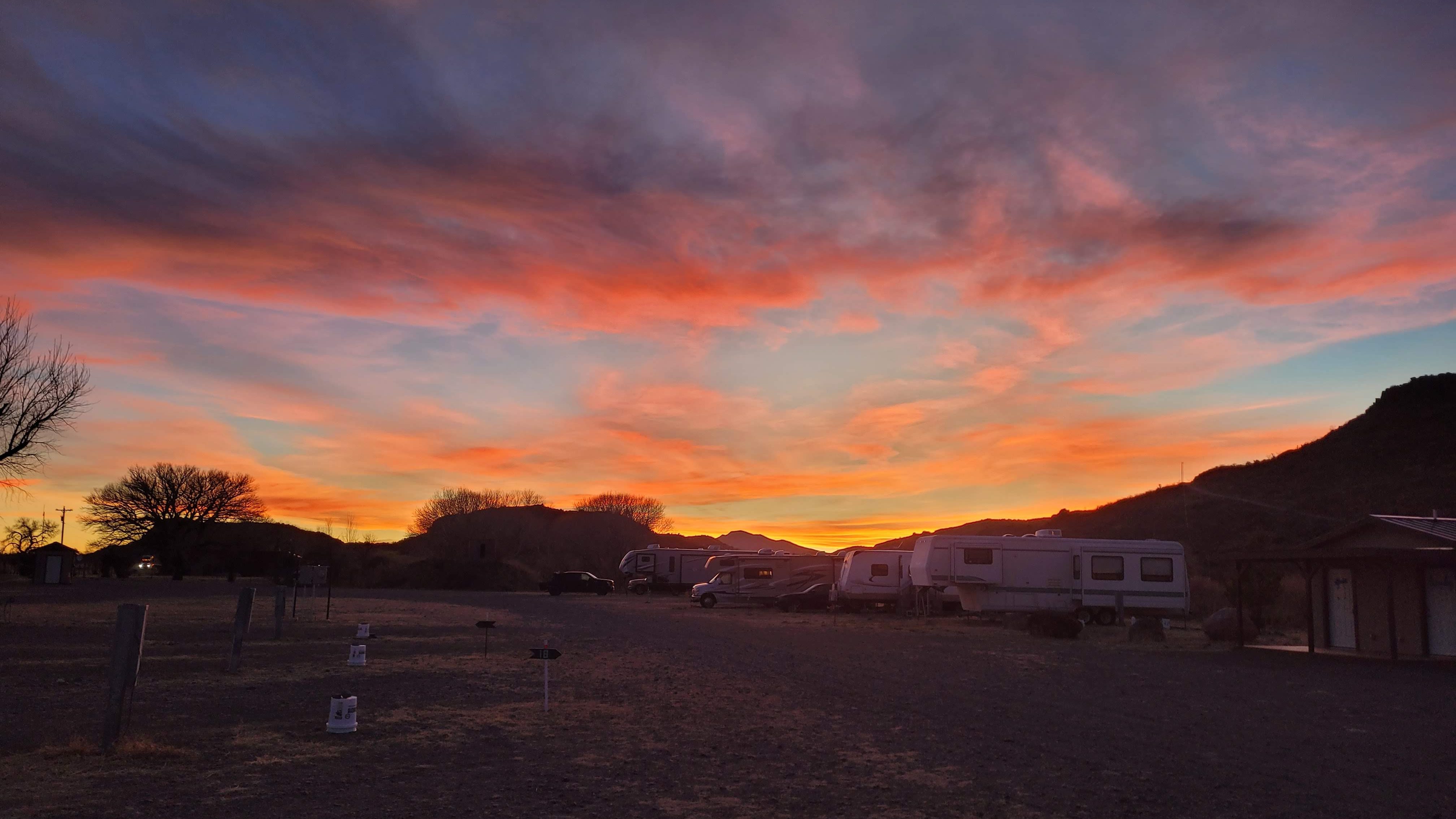
We pulled into Davis Mountains RV Park just as the light was starting to shift. It ended up being one of those campsites that steals the show. Right behind us, we had a clear view of the mountains rising up, nothing blocking it. Just open land and rugged peaks.
And the sunsets. Every single evening, the sky would turn this soft pink that slowly spread across the mountains and the desert floor. Not overly dramatic, just really, really beautiful.
Of course, West Texas also made sure we didn’t get too comfortable. The wind picked up hard at night, strong enough to make the bus shake while we were trying to sleep. It brought back memories of that questionable night we spent along the Cabot Trail, listening to the wind howling outside our tent and making us regret certain life choices. There was also the constant threat of “goat heads,” these tiny but brutal sharp seed pods scattered all over the ground around the campsite. They stick straight into the bottom of your shoes, then somehow would make their way inside the Bus, where you inevitably step on one again in what you thought was a safe, barefoot-friendly zone.
Davis Mountain State Park
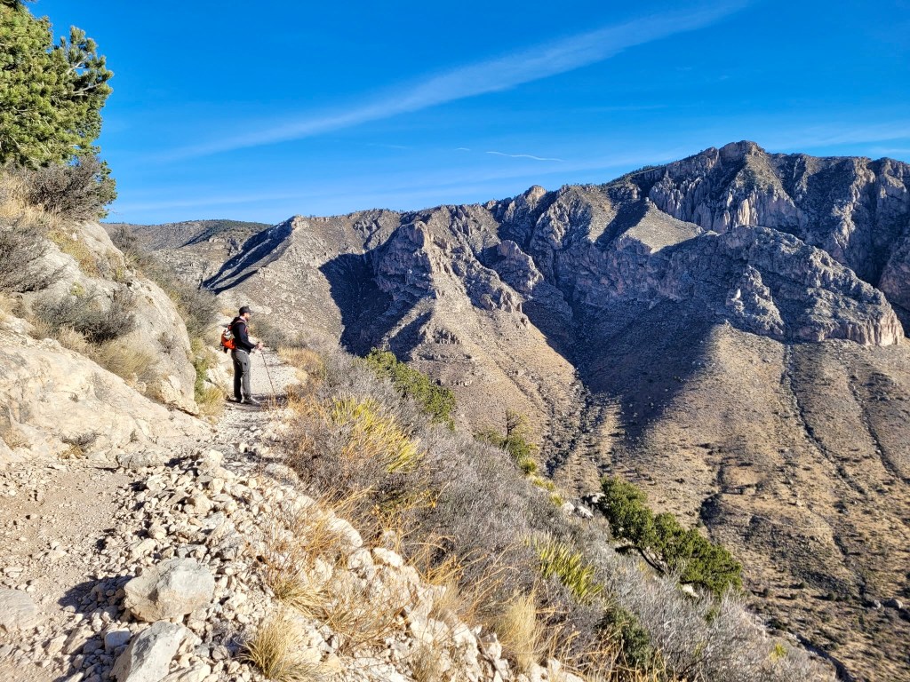
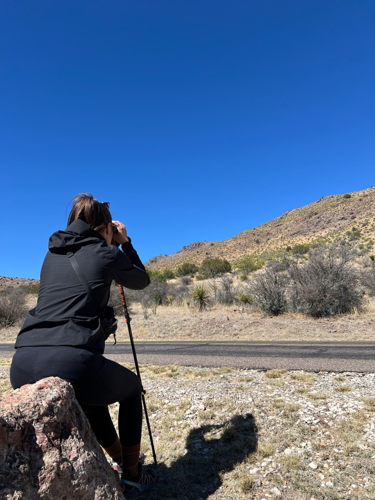
Our first Monday here was a holiday, we decided to spend it the best way possible, outside. We headed to Davis Mountains State Park for a full day of hiking and went with the Old CCC Trail and the Skyline Trail, which turned out to be a solid choice.
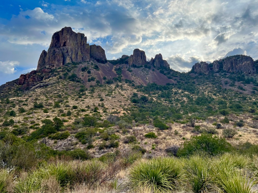
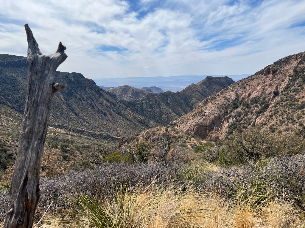
The park sits in the foothills of the Davis Mountains, and it feels completely different from the flat desert you drive through to get there. These mountains were formed by volcanic activity about 25 to 30 million years ago, and you can really see it in the terrain. The rock is layered, dark in places, and exposed along canyon walls and ridgelines. As you hike, you move through areas like Frazier Canyon and past formations like Sleeping Lion and Barrel Springs, which give the whole place a bit more character.
The topography keeps changing as you go. Lower down, it’s dry and rugged with open views. As you climb, the terrain tightens into canyons and ridges, and you start gaining elevation pretty quickly. The park sits around 5,000 to 6,000 feet, which sounds like it should make a difference. In reality, if uphill hiking already has you out of breath, this just feels like… more of the same. Still climbing, still questioning your choices, just with a better view.
What stood out most was how much life there is out there. It’s not just desert. You’ve got oaks and junipers scattered across the hills, grasses covering the ground, and even pinyon pines higher up, which feel slightly out of place but somehow fit. Then there’s the cacti, everywhere. Some small and easy to miss, others very clearly there to remind you to watch where you step.
Wildlife-wise, we actually got pretty lucky. We spotted a few javelinas, and heard birds pretty much the entire time. The American Bird Conservancy has recognized Davis Mountains State Park as a Globally Important Bird Area. The park is home to over 260 species of birds and provides refuge to several species of concern. The newly-constructed bird blind offers an enclosed viewing station, a shielded outside patio, and watering and feeding stations. It is a great place to view scrub jays, white-winged doves and acorn woodpeckers.
The trails themselves were great. The Old CCC Trail winds you through the canyon with a steady, consistent climb, while the Skyline Trail brings you higher up along the ridges with wide views over the mountains and desert below. It’s the kind of hike where the scenery keeps changing just enough to distract you from the burning legs.
And that was just our first visit.
We ended up going back later in the trip because it felt like we hadn’t quite seen enough. This time we started at the Indian Lodge Trail near Black Bear Restaurant, and it turned into one of those unexpectedly memorable hikes.
At one point, Chris is walking ahead of me and just stops. No warning. Binoculars come out immediately. Another episode of Chris and his knockers begins.
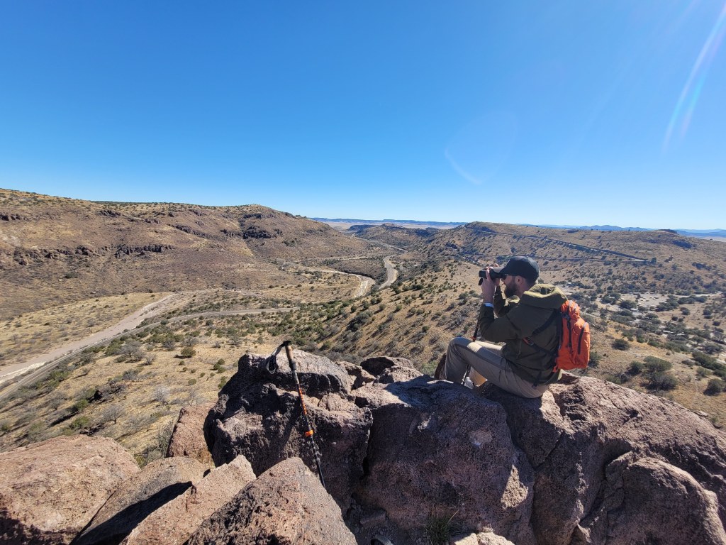
He is completely locked in, staring down into the ridge. Meanwhile, I’m behind him squinting into the distance like that’s going to magically improve my vision. No binoculars, no glasses, no clue. Just standing there pretending I also see something important.
Eventually, I get the update.
And honestly, they look like they were built for this place. Sandy-colored, perfectly camouflaged against the rock, long legs, and just casually standing on steep terrain like gravity is optional. They move around like it’s nothing, while we’re out here carefully watching every step on a marked trail.
They were aoudad (Barbary sheep)—a wild sheep species originally from the rocky mountains of North Africa. They were introduced to parts of the southwestern U.S. in the 1900s and have since become an invasive species, spreading into rugged desert and canyon landscapes where they compete with native wildlife and are notoriously hard to manage due to how well they adapt to steep, arid terrain.
We ended up spotting them again later from above, which made for a much better view. Naturally, the binoculars made a second appearance, and we took a minute to just watch them move through the landscape.
The sky was completely clear, bright blue with no clouds, and it made everything stand out more. The dark volcanic rock, the dry terrain, the scattered vegetation. It’s not lush, but it doesn’t feel empty either. Just raw and really well put together.
Guadalupe Mountains National Park
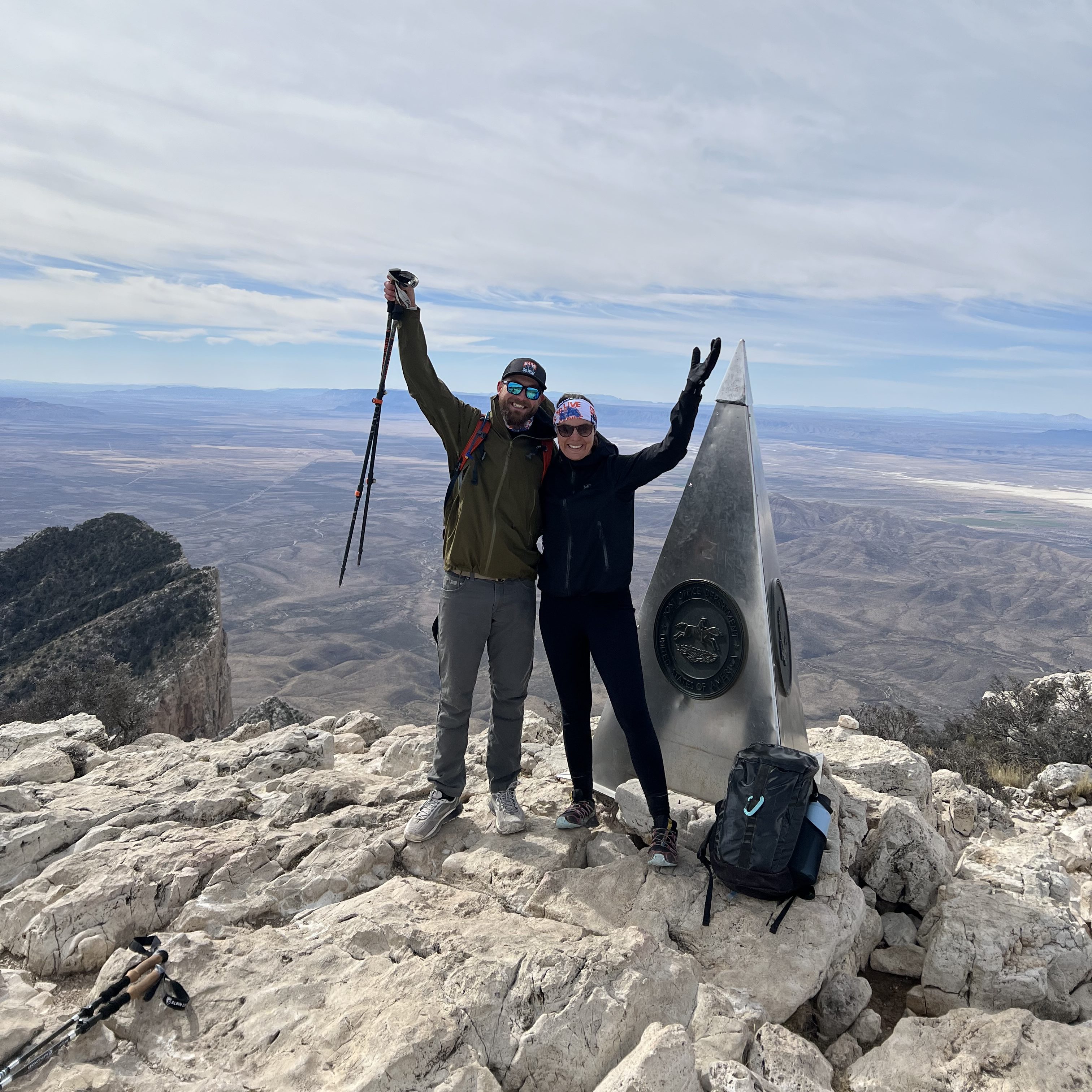
As outdoor enthusiasts, we tend to make the most of every available hour of daylight. On this particular Saturday morning, we set our alarms for 5 am, which already feels questionable. But stepping outside makes it worth it. Pitch black, quiet, and a sky full of stars. The kind of sight that makes you pause for a second before remembering… oh right, we’re about to hike the highest peak in Texas.
Coffee was non-negotiable. We made it in the dark, half awake, then hit the road for the 2.5 hour drive to Guadalupe Mountains National Park.
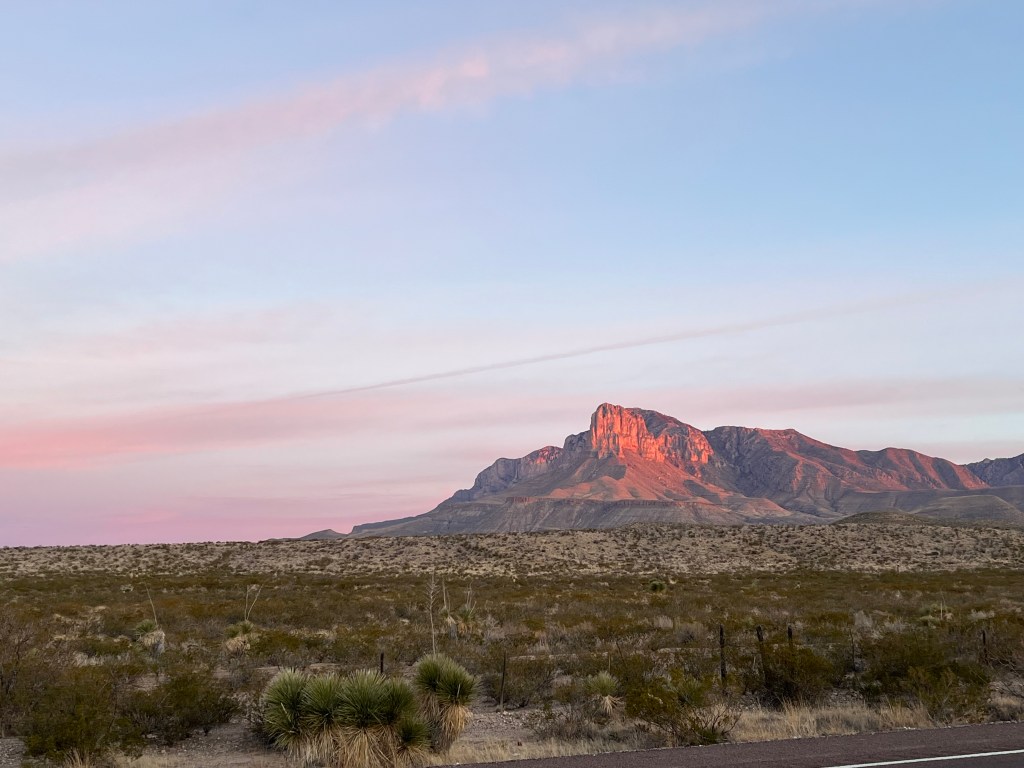
As we got closer, the sun started to come up, and we could see El Capitan and Guadalupe Peak lighting up in that early morning glow. It’s one of those views that makes you go quiet for a minute. Also one of those moments where you think… we’re hiking up that?
For context, Guadalupe Peak sits at 8,751 feet, and the park compares the climb to walking up the Empire State Building three times. THREE. TIMES. If I thought my cardio needed work before, this hike really confirms it.
It was also surprisingly cold. Like gloves and windbreaker the entire time kind of cold. And if you know me, that says a lot because I am usually overheating five minutes into any hike.
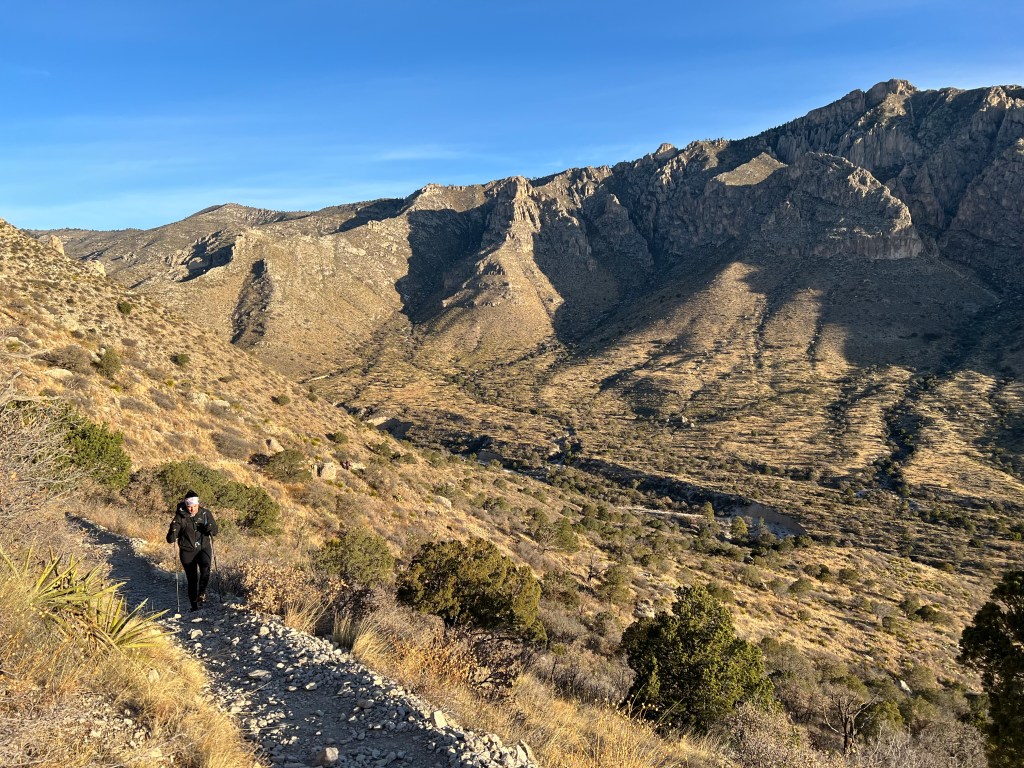
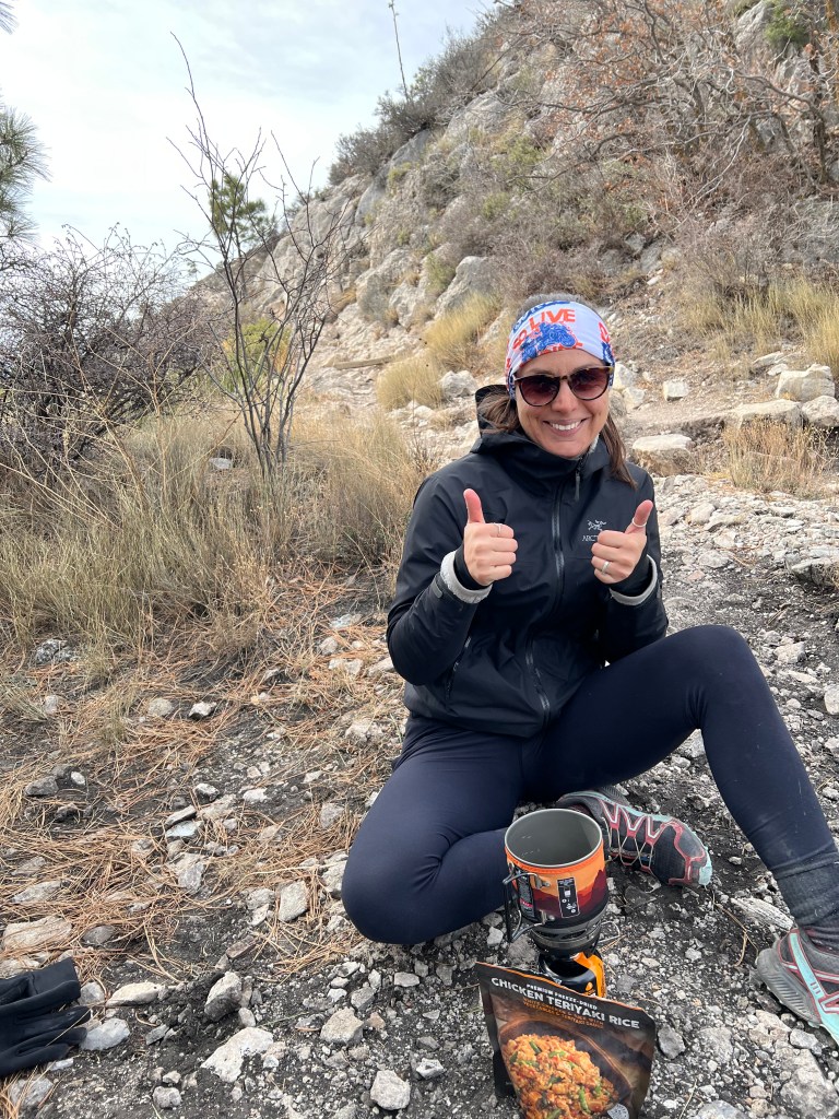
The trail started climbing right away. Basically a long series of switchbacks that just kept going. And going. And going. The higher we got, the windier it became. By the time we reached the top, it was straight up brutal. Cold, windy, and absolutely not the vibe for our usual “cute snack at the summit” moment.
So we admired the views, took it all in, and then very quickly decided… yeah, we’re eating somewhere else.
On the way down, we found a tucked-away spot just off the trail in a little wooded area that blocked the wind. Perfect. Out came my mini camp stove, and I started boiling water for the dehydrated meal I had packed.
Side note. Chris definitely thought it was over the top when I loaded up my Patagonia 22L day pack that morning. But halfway through a 9 mile hike, when hunger hit, suddenly it wasn’t overkill anymore. Funny how that works.
Honestly, that hot meal hit harder than anything we could have had considering we were still feeling chilly from the windy conditions.
The hike down though… different story. By the end, my knees were absolutely done. Like fully negotiating with each step. At one point I thought, wow, this is how I go from “active adult” to “needs a walker” in a single afternoon.
Also, I stand by this theory: what you crave after a hike says a lot about you as a person. Me? Gummy bears.
We found some at the visitor center made from prickly pear, which sounded promising. The reality? Not exactly what I expected. But did that stop me? Absolutely not. The whole bag was gone in under 20 minutes.
By the time we made it back to Fort Davis, options were limited, so we went straight for carbs. Pizza and hard cider. No hesitation. And honestly, it might have been one of the best meals of the trip.
We rolled back to the Bus just as the sun was setting, completely exhausted, a little sore, and already talking about what to do next.
West Texas was really starting to grow on us.
Big Bend National Park: The South Rim Hike
Another day, another alarm going off at a time when the sun has not even thought about showing up yet. Again, we’re driving 2+ hours south this time to tackle a 14 mile hike on the South Rim Trail in Big Bend National Park. At this point, I’m still holding onto the optimistic idea that my cardio will eventually catch up to my enthusiasm and stop making every incline feel like a nightmare.
The drive into the park starts with long stretches of open desert, then slowly funnels you into the dramatic geology of the Chisos Mountains. These mountains are actually volcanic in origin, formed by ancient eruptions and later erosion, which explains the layered rock, steep canyon walls, and sharp contrasts in color as you move deeper in. You go from wide desert flats into narrow, winding roads that climb into the basin, with cliffs and rock faces stacking up on either side like they were carved on purpose.
Once on the trail, the landscape continuously shifts as you gain elevation. The lower sections are classic desert terrain—dry, open, and dotted with hardy shrubs and cacti—before gradually giving way to rocky slopes and exposed ridgelines. The higher we climb, the more the landscape opens up around us, revealing sweeping views over the desert below, with mesas and distant mountain ranges layered all the way to the horizon.
Scattered along both sides of the trail are the remnants of burned trees, a quiet reminder of past fire events and the resilience of this ecosystem. Even in its most rugged and seemingly unyielding moments, the landscape is constantly rebuilding and adapting.
It’s also a surprisingly active wildlife area, especially for birds of prey. We spotted Peregrine Falcons riding thermals along the cliffs, barely moving, just letting the wind do the work. Turns out this area is an important habitat for protected raptors, which makes sense once you see how perfectly they fit into the landscape.
At the top of the South Rim, everything just opens up. Massive drop-offs, endless desert views, and that feeling that you’re standing on the edge of something much bigger than it looks on a map. We stopped there for lunch, which in our case means a dehydrated meal situation powered by my very necessary mini camp stove. Yes, again. Chris may or may not have questioned the packing choices beforehand, but at 7,000+ feet with wind picking up on a cliff edge, hot food suddenly feels like genius-level planning.
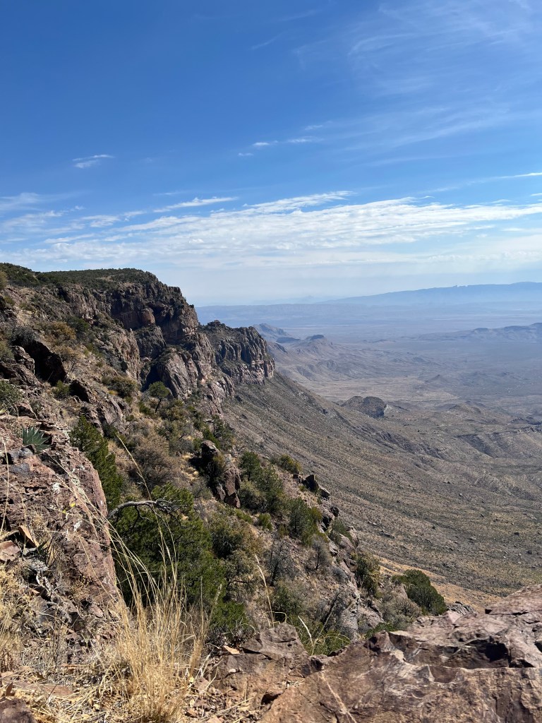
After a long break soaking in the expansive view all the way into Mexico, we eventually made our way back down, passing more of those wide canyon views and catching the light shifting across the rock as the day moved on.
Later, we learned that the trail was going to be closed the very next day for conservation work to protect the area and its wildlife, including those falcons we had been watching without even realizing how closely managed they were. It made the timing feel a little extra special, like we just squeezed in before the pause button was hit.
Definitely one of those hikes that sticks with you, both for the scale of the landscape and the reminder of how carefully it’s being preserved.
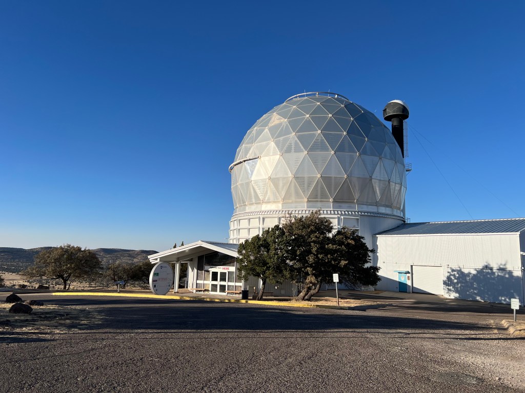
Star Party at The University of Texas McDonald Observatory
One of the things that makes Fort Davis unique was visiting the McDonald Observatory for their Star Party.
The observatory sits high up in the Davis Mountains, far away from city lights, which makes it one of the darkest skies in the country.
Once the sun set in the horizon and it got dark, the constellation tour started with a group presentation in this open-air amphitheater. The astronomer uses a laser pointer to trace shapes across the sky. It sounds simple, but it’s actually really cool to watch someone connect the dots in real time. Side note, most of the men in the amphitheater seemed more impressed by the laser pointer being visible in the sky than the actual star formations we were supposed to be impressed by.
We started picking out some of the more recognizable constellations like Orion, which is one of the easiest to spot because of the three bright stars that form Orion’s Belt. From there, they pointed out Ursa Major, which includes the Big Dipper, and explained how travelers have used it to navigate for centuries.
They also talked about how these constellations got their names. Most of them go back to ancient Greek and Roman times, when people used the stars to tell stories about gods, hunters, and mythical creatures. It’s kind of wild to think that the sky we’re looking at is the same one people were mapping thousands of years ago, just with way less light pollution.
After the presentation, we moved over to the telescope viewing area. There are multiple telescopes set up, each one focused on something different. One might be locked onto a star cluster, another on a planet, another on the moon. You just move from one to the next, and the volunteers explain what you’re looking at.
Because it was a full moon, the sky looked a little different than expected. Fewer faint stars, but the moon itself completely stole the show. Through the telescopes, you could see the surface in crazy detail. Craters, ridges, shadows. Way more texture than you ever notice just looking up on your own. It almost didn’t look real.
We saw quite a few bright stars, and learned how their color actually tells you something about their temperature. Blue-white stars are hotter, while orange and red ones are cooler.
At one point, they pointed out a faint, hazy patch that didn’t look like much to the naked eye, but through the telescope turned into a dense cluster of stars. That was one of those moments where it really clicks how much is out there that we just don’t see.
It’s not a fast experience, you wait your turn, and you look with wonder. But that’s kind of the point. By the end of the night, it felt like we had learned just enough to recognize a few things on our own, but also realized how much we don’t know.
Driving back in the dark, with the mountains barely visible and the sky still wide open above us, it felt like the kind of night you don’t get very often.
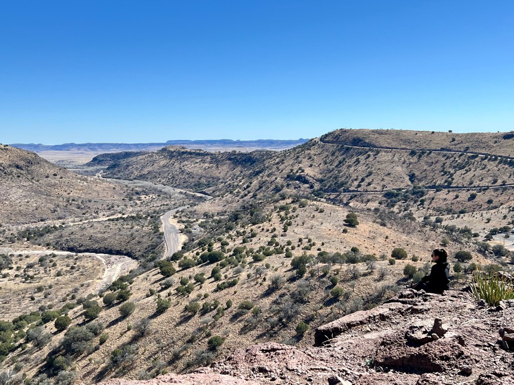
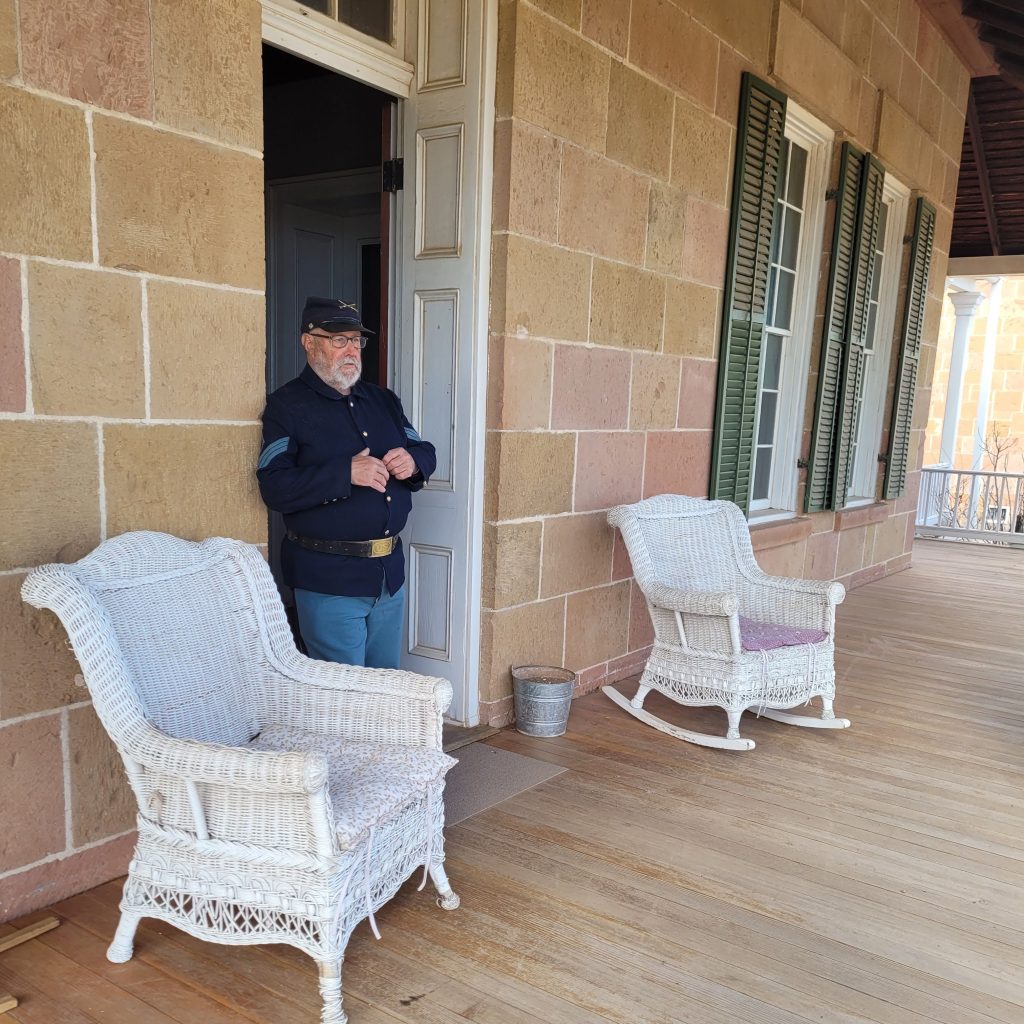
Fort Davis National Historic Site
We also visited the Fort Davis National Historic Site, one of the best-preserved frontier military posts in the American Southwest, set within a dramatic mountain pass at the base of the Davis Mountains. After starting in the museum, which does a great job of grounding the site in its 19th-century frontier context, we joined a guided walking tour led by an interpreter dressed in a historically accurate U.S. Army uniform. That detail alone made it feel like stepping back in time.
The fort itself is spread across a wide, open valley framed by rugged limestone and volcanic rock formations—terrain that once made it a key strategic corridor through West Texas. The buildings are arranged in a clear military order: long, low enlisted men’s barracks, the more refined officers’ quarters with shaded porches, and functional structures like the hospital, commissary, and quartermaster buildings, all restored or stabilized to reflect their original footprint. You can still read the logic of frontier military life in how everything is spaced—practical, exposed, and designed for visibility and control in a remote landscape where resources were limited and conditions harsh.
Geologically, the site sits at a transition zone between desert basins and uplifted mountain terrain. The surrounding Davis Mountains are part of an ancient volcanic field, which explains the layered rock, jagged ridgelines, and the stark contrast between flat valley floor and steep surrounding slopes. This landscape shaped everything about the fort’s placement and purpose: it was built to monitor movement through the pass and assert control over a region that had long been traversed by Indigenous groups such as the Apache, who used these same routes for trade, migration, and seasonal movement long before the U.S. military established a presence.
Our guide also did a great job of explaining that history with nuance—describing how interactions between Native American communities and American soldiers were not one-dimensional, but ranged from conflict and forced displacement to moments of negotiation, dependence, and uneasy coexistence. Standing among the restored buildings, with the mountains rising on all sides, made it easier to understand why this location mattered so much—both strategically and culturally—within the broader story of the frontier West.
Honorable mention: When the campground gifts us only excellent neighbors
I’ve said this multiple times over the last year: one of the best parts of traveling is the people you meet along the way. It really is a privilege to talk to people from all over. Some are on their own journeys, others are locals you get to meet in their home places. Most interactions are brief, a nice conversation that fades as everyone moves on. But every now and then, you meet people you actually stay in touch with.
Enter Bill and Valory.
They pulled into the campsite one evening mid-hustle, trying to get their rig set up quickly so they would not miss the Star Party at McDonald Observatory. You know that slightly chaotic “we need to park, plug in, level, and immediately leave” energy.
We chatted here and there over the next couple of days, in between everyone’s packed schedules, and quickly realized they were just the sweetest couple. They are from Michigan and doing a month-long trip.
Since timing never quite lined up at the campground, we ended up exchanging phone numbers and loosely planning to meet up later in Terlingua, since Chris and I were heading that way on the motorcycle the following Saturday.
And we actually did it, which, let’s be honest, is not always guaranteed when people say “we should meet up sometime.”
We met for lunch at Venga Cafe and ended up having such an easy, natural time getting to know each other properly. The kind of conversation that flows so easily you forget you originally met in a campground parking lot a few days earlier.
We even crossed paths again at Balmorhea State Park in West Texas, a remarkable desert oasis in the Chihuahuan Desert, before they continued on toward San Antonio. The park is centered around San Solomon Springs, one of the largest natural springs in Texas, which feeds a massive spring-fed swimming pool built by the Civilian Conservation Corps in the 1930s. The water stays a constant, crystal-clear temperature year-round and supports a surprisingly diverse aquatic ecosystem for such an arid landscape.
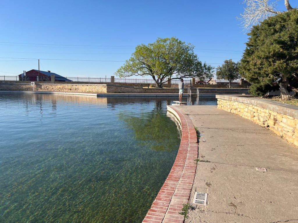
Quick side note—Balmorhea also has those tiny fish that gently nibble at your feet in the water, which is both strangely relaxing and slightly unsettling.
And then came Yvonne and Craig. Another fantastic couple, this time from Texas. We had a great time talking with Craig and listening to his deep Texan accent and slow cadence. His sense of humor was impeccable.
Once he picked up on my extroverted and easily impressionable personality, he summed it up perfectly: “You’re like a chicken, every day you wake up to a new world!” No truer or funnier words have ever been said.
He also shared a story about visiting his family in the Pacific Northwest, where the pace of conversation tends to be noticeably faster and more clipped. While there with them, he went to order food at a drive-through and found himself in one of those unexpectedly funny communication mismatches—he speaks a bit more slowly and deliberately, and the person on the other end was clearly not quite catching his rhythm. From his perspective, the order was simple enough that it shouldn’t have been complicated, which only made the moment more amusing as it unfolded.
In his telling, what made it even funnier was the contrast in styles—him calmly working through the order, and the drive-through pace moving at full speed—turning a routine stop for food into a surprisingly chaotic little exchange.
It’s funny how travel works sometimes. You go for the landscapes, the hikes, the big “must-see” places, and the sweeping views you’ve seen in photos—but what often stays with you most isn’t any of that. It’s the people you meet in between, and the small, unexpected moments that happen along the way. The conversations, the shared stories, the chance encounters that weren’t on any itinerary—those are the parts that linger long after the trip is over.

Liked this post? Leave a comment.