Welcome back to the Kickstand Chronicles. If you caught the spoiler in the last entry, you already know Arkansas wasn’t just a pit stop. We’d stumbled upon a full-blown adventure motorcycle paradise. It was compelling enough to make our plans revolve around this as we were curious to see just how deep this Arkansas rabbit hole would go.
A few days after settling in, a big A-class camper rolled into the campground, unloading some adventure motorcycles and a side-by-side. My internal radar immediately went off. Before I could overthink it, I was already halfway out the door and smiling. Chris looked up from his computer monitor, just in time to offer a gentle warning. Something along the lines of maybe don’t overwhelm them. A fair concern, considering my well-documented enthusiasm for meeting new people and my occasional blind spot when it comes to social cues.
Still, curiosity won.
I wandered over and launched into the usual rider small talk with our new neighbors, Roger and Sara. What do you ride? Where are you from? How often do you ride here? I then get asked a question I wasn’t expecting. Are you here for the ADV Rally?
I explain that this is the first I’m hearing of it, but that I am extremely interested in knowing more. Turns out that the So Live So Ride Moto Ranch we’d spotted a few days earlier is hosting its Fall Adventure Rally. Well I’ll be!
Before long, another van pulled into the campground. A couple hopped out and began unloading their adventure bikes. My heart did a little fist pump at the prospect of making more friends.
That’s how I met Angga and Lee, visiting from Kansas. As we swapped motorcycle stories and compared setups, Lee casually mentioned he was heading over to the Moto Ranch to sign up for the weekend and see what the schedule looked like. Then he asked, almost as an afterthought, if I wanted to come along.
I gleefully agree, heading back to our camper to throw on my gear, and sprinting (yes, sprinting like a child) back to the Bus to deliver the news to Chris. “I’m heading to a moto ranch with the nice man I just met over there,” pointing towards their camper van, “to get information about the motorcycle rally. I’ll be back!”
Chris barely had time to process this before replying, “Uh. Okay. Be safe! See you later.”
And just like that, I was on my motorcycle, driving off with the nice man. All this courtesy of campground timing, adventure bikes, and the kind of coincidences that seem to appear only when you’re already exactly where you’re supposed to be.
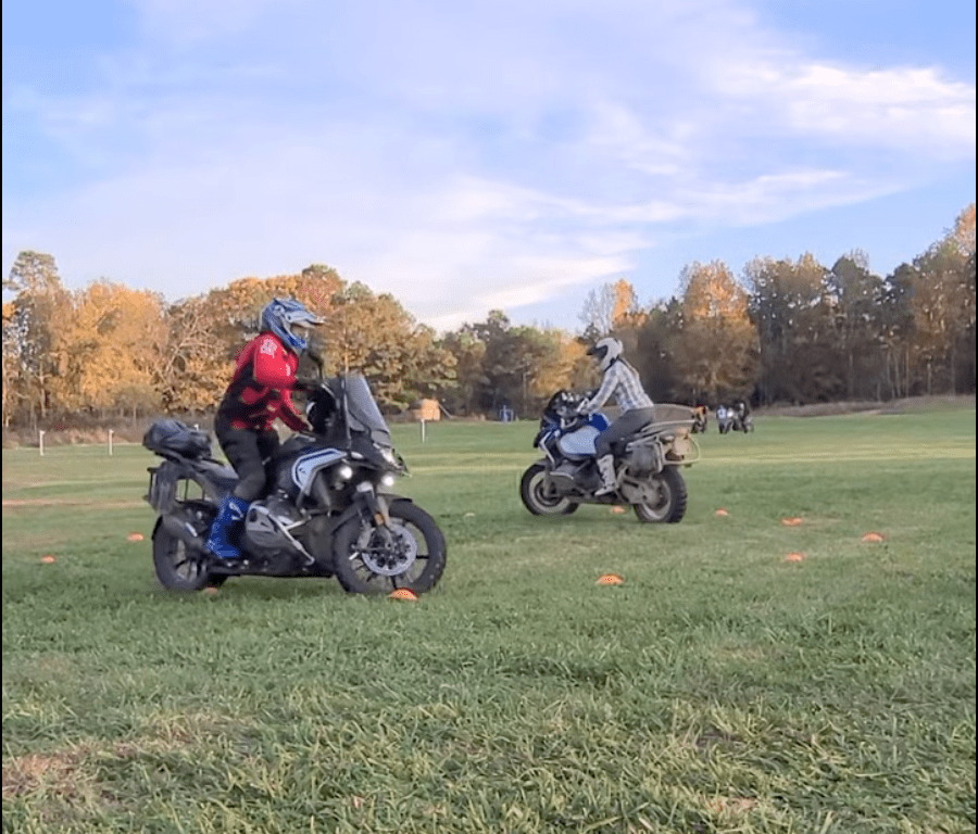
Pulling into the So Live So Ride Moto Ranch, the back field is already dotted with camping tents and Sprinter vans. A white pop-up tent greets us near the entrance, surrounded by adventure bikes and clusters of riders swapping stories. Off to the right, another field is set up with obstacles: barrels, cones, a series of evenly spaced, consecutive mounds of dirt bike whoops.
I park near the tent and introduce myself to the folks under the tent: Kate and Kim. Kate and her husband Dustin1 own the ranch and organize this event. They are casual legends, in their own right, I soon find out.
We chat about the schedule for the next few days, the organized rides, and how to sign up to explore the surrounding trails. All skill levels are welcome, and a quick glance around confirms it. Every age group, nearly every adventure bike brand, are represented. I ride back to camp buzzing with excitement and fill Chris in. Our very first motorcycle rally!
Tales From the 3-Day Moto Rally
Today is Thursday. After Chris’ workday ends, we head back to the ranch to watch the Cha Cha Trail Time Trial. Riders thread their way through a tight labyrinth that is carved through a high grass field as fast as possible. The ground is slick, the turns are unforgiving. When people fall, they bounce back up and keep going. Skills on full display. As evening settles in, we gather around a campfire where stories are traded and trail maps are discussed. We’re told that the routes are clearly rated by difficulty online.
The next day, Chris takes a half day from work and we decide to explore on our own before heading back to the Moto Ranch later in the afternoon. When it comes to planning our rides, I’m not in charge of maps as the GPS screen is set up on Chris’ bike. Plus, my spacial awareness skills are so subpar I would probably get lost if I had directions spelled out for me on my dashboard.
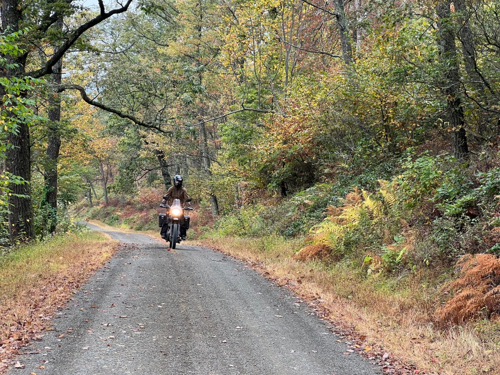
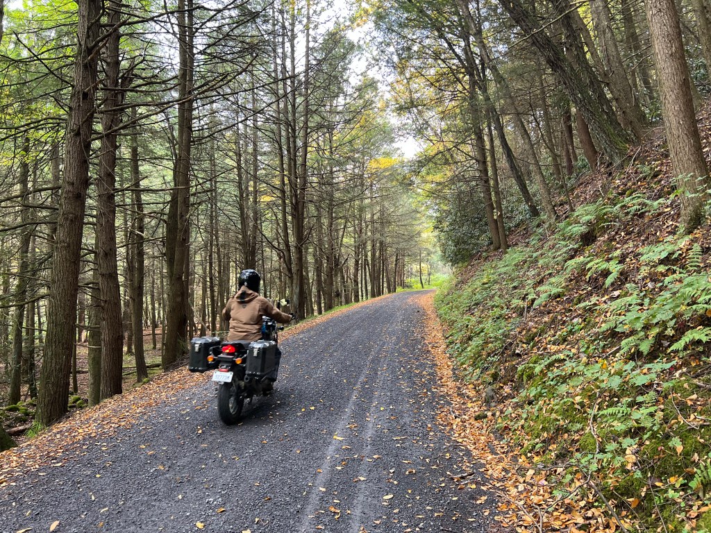
The ride starts out easy enough, as we wind through smooth gravel roads, that twist as we follow the edge along Ludwig Lake before heading back under the cover of fall colored trees. It’s all so pleasant and fairly easy going.
Then Chris casually asks, “Are you up for something a little more challenging?” I can do a little more challenging and so enthusiastically agree without asking a single follow-up question.
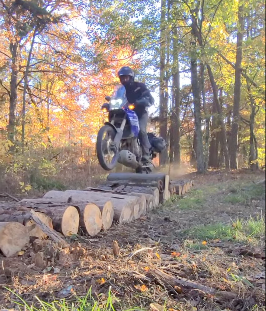
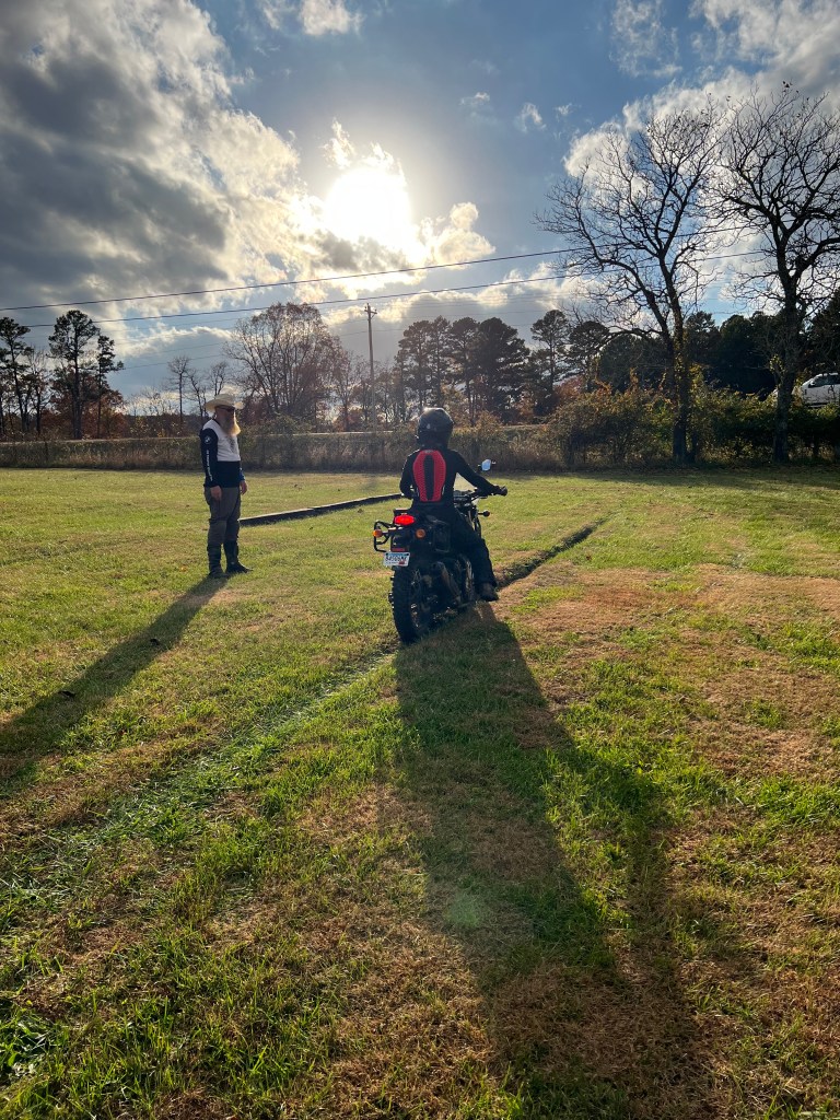
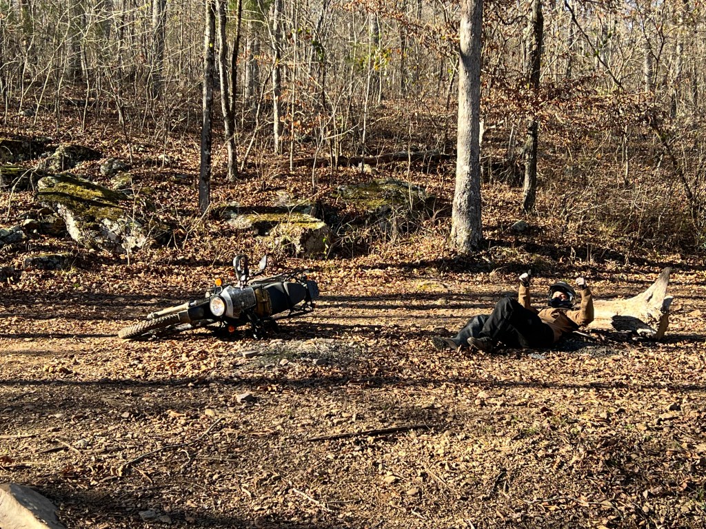
At the fork in the road, we turn left onto a little more challenging route. Almost immediately the terrain turns rocky, rutted, and slick with mud. Surprisingly, I start off feeling confident and capable. And then the road begins to thoroughly kick my ass. With part of the trail named Fist Fight, I should have known better.
Chris sails up a steep incline with ease. I follow, unaware that I’m in third gear instead of first. I try to power my way up, stall, and wipe out sideways into the washed-out trail. Everything’s fine, I say over the comms, as Chris rushes back to help me right the bike. We push on.
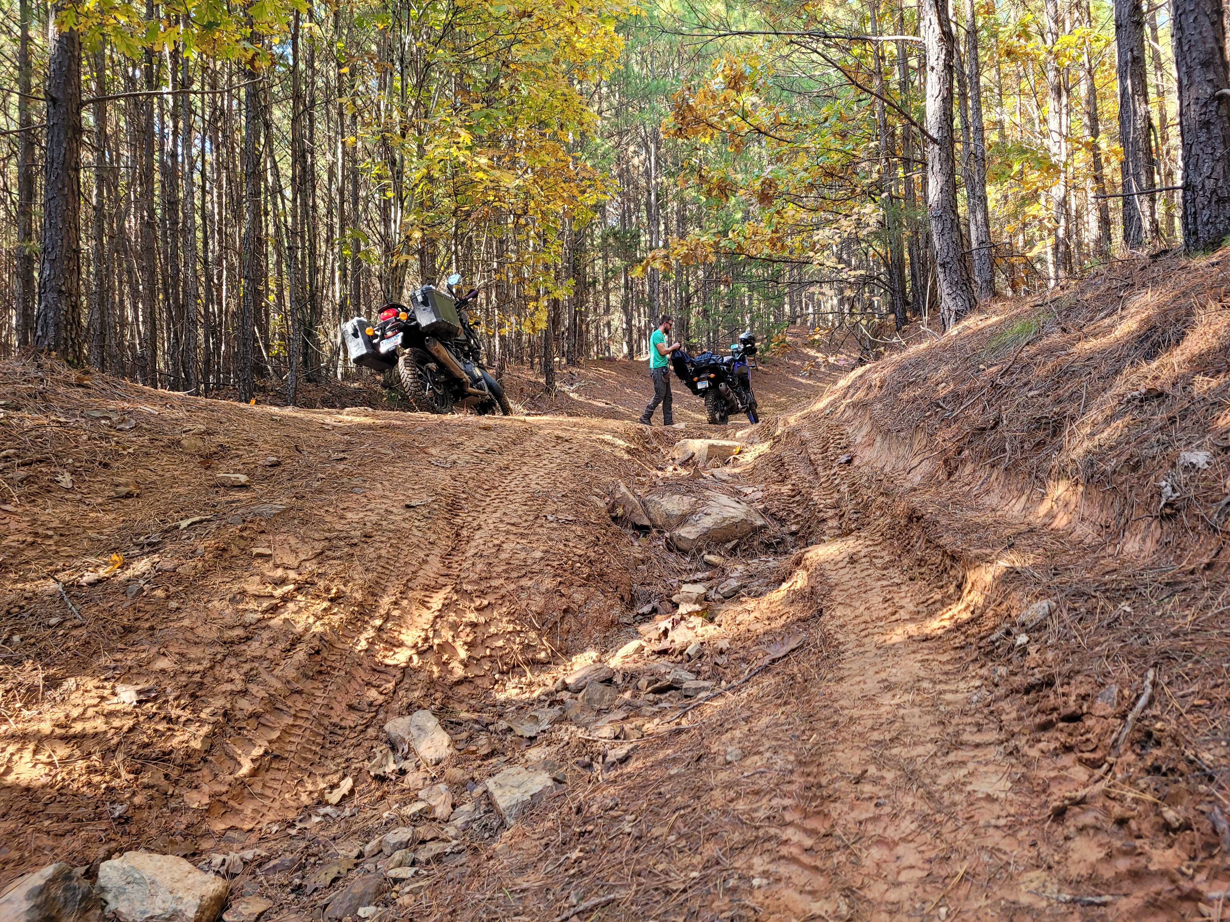
A bit later, my front tire hits a rock (a fairly large one), the bike stops dead, and I go over the handlebars. This is my first ride wearing the chest protector my brother-in-law insisted I take. Thank goodness for that, because I get the wind knocked out of me as I land on the ground, mirror in hand. This is also when I’m glad to have replaced my stock mirrors with Ram-mounted adventure mirrors that are able to take the brunt of a fall without breaking.
By the time we reach a particularly rocky and technical section, my energy is fading fast. Chris stops to analyze the line ahead, while I realize that every stop-and-start is draining whatever reserves I have left. Damn you, inadequate cardio! I decide that momentum is the answer. If I don’t stop, I won’t have to restart, right?
Oh boy.
I vaguely hear Chris warning me to stop and analyze what’s ahead. I ignore him. He raises his voice, understandably panicked as I barrel toward him. What I attempt to shout between gasps is something like, “If I stop, I won’t be able to start again!” I know it’s absurd, but I commit. For about three bike lengths. Then I crash. Again.
Chris jogs over, and delivers a firm lecture about if you get hurt, you won’t be able to go anywhere. I push back weakly, questioning whether I should even be on this trail. What level is this damn thing, anyway? It would seem that the first route we passed was rated 1.0. The second was a whopping 3.0.
I can confirm that I wasn’t ready to experience such a sudden jump in difficulty level. Nevertheless, I’m proud of having tried my best and gotten through nearly unscathed with no parts on my bike completely broken off.
Chris rides my bike to the end of the section while I walk it out, pondering my life choices and wondering if there’s a way to be better at this. Another spoiler alert: there is.
We finish the afternoon with a beautiful and much more mellow ride through the Ozark forest before heading back to the ranch to watch more skills challenges.
On the way back we stopped at Grumpy’s burger barn to grab some food. Partly because it’s supper time, but mainly because I am in need of comfort food after that afternoon ride. We end up eating the best pulled pork sandwich either of us has ever tasted.
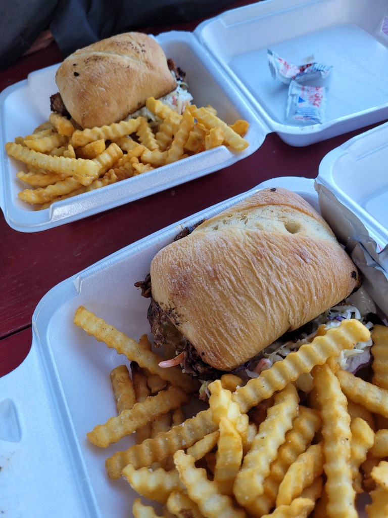
Grumpy’s is literally a trailer on the side of the road with a big smoker drum right behind it. And for those of you who are wondering, it’s called Grumpy’s because they play their role very well. Taunting clients to order something specific on the menu and giving you a hard time when you seem to want to over complicate things about their menu. It’s perfectly charming!
As we roll back through the gate at the moto ranch, engines ticking as they cool, the Ozark dusk settles in. We arrive just in time for the evening’s challenges, a kind of moto rodeo that feels equal parts skill clinic and summer camp for grown riders.
First up are the barrel races.
It is the same concept as on horseback, except instead of reins and a galloping partner, you rely on throttle control and clutch finesse. You burst out of the gate, dive hard right around the first barrel, cross diagonally to sweep left around the second, then hustle to the center top barrel before launching back toward the finish. Fastest time wins.
Simple enough on paper.
On big adventure bikes such as BMW GSs, Africa Twins, and KTMs, it becomes a dance of balance and determination. Even in a groomed arena, the surface is loose gravel over hard-pack, and if you grab too much front brake or hesitate mid turn, you are flirting with gravity. Drop your bike at any point and you are disqualified.
The engines rev. Tires bite. A few riders come in hot and wide. One misjudged line nearly topples a fully loaded GS. The crowd cheers, half encouragement and half relief.
Then come the slow races.
Chris gives it a go and instantly realizes how deceptive “slow” really is. Riding fast feels instinctive. Riding painfully, deliberately slow without putting a foot down requires discipline. The key is clutch control, steady throttle, and tiny body adjustments. On these uneven grassy surfaces, even the smallest rut or incline can tip your balance. Riders wobble. Boots hover nervously above the ground. A single dab of a foot means you are out.
Dustin remains the undisputed king.
He inches forward with almost supernatural composure, at times appearing completely motionless. His front wheel trembles but never falters. While others glance sideways to assess their competitors and lose focus just long enough to dab, Dustin rides his own race. Calm and unbothered. He crosses the line at a pace that feels glacial but triumphant.
Then comes the slow circle showdown. Also known as “knife fight in a phone booth”.
Cones form a tight ring, roughly 25 feet across, barely enough room to maneuver a bicycle, let alone a 500 pound adventure bike. It is a last rider standing duel. The objective is not speed. It is psychological warfare. You creep toward your opponent, trying to pressure them into losing balance and putting a foot down.
Big bikes. Tight circle. Zero room for ego.
The ladies shine here.
Kate and Kim glide around the circle on their BMW GS bikes as if the machines weigh nothing. Feathering the clutch, subtle counterbalance, steady throttle. Effortless. It is mesmerizing to watch. Strength is not the story. Control is. Confidence is.
As riders gather around the fire, stories begin to flow. There are creek crossings on Warloop Road, ledgy climbs on Mill Creek, slick descents where red clay behaves like grease. Route recommendations bounce from group to group.
Chris mentions that we rode Guns and Wiemers and part of Fist Fight. The reaction is immediate. Eyes widen. A few low whistles. Someone mutters that those trails are no joke.
Both are notorious in the local Ozark riding community. Guns and Wiemers is steep, rocky, and relentless. Loose baby head rocks scatter across off camber climbs where momentum becomes your only friend. Fist Fight earns its name honestly. Tight switchbacks. Jagged limestone shelves. Deep ruts carved by runoff. Climbs that demand total dedication. Congratulations are offered. I quickly clarify that it was a complete struggle and that I had absolutely no business being on that trail. We made it through, but it was deeply humbling. We laugh.
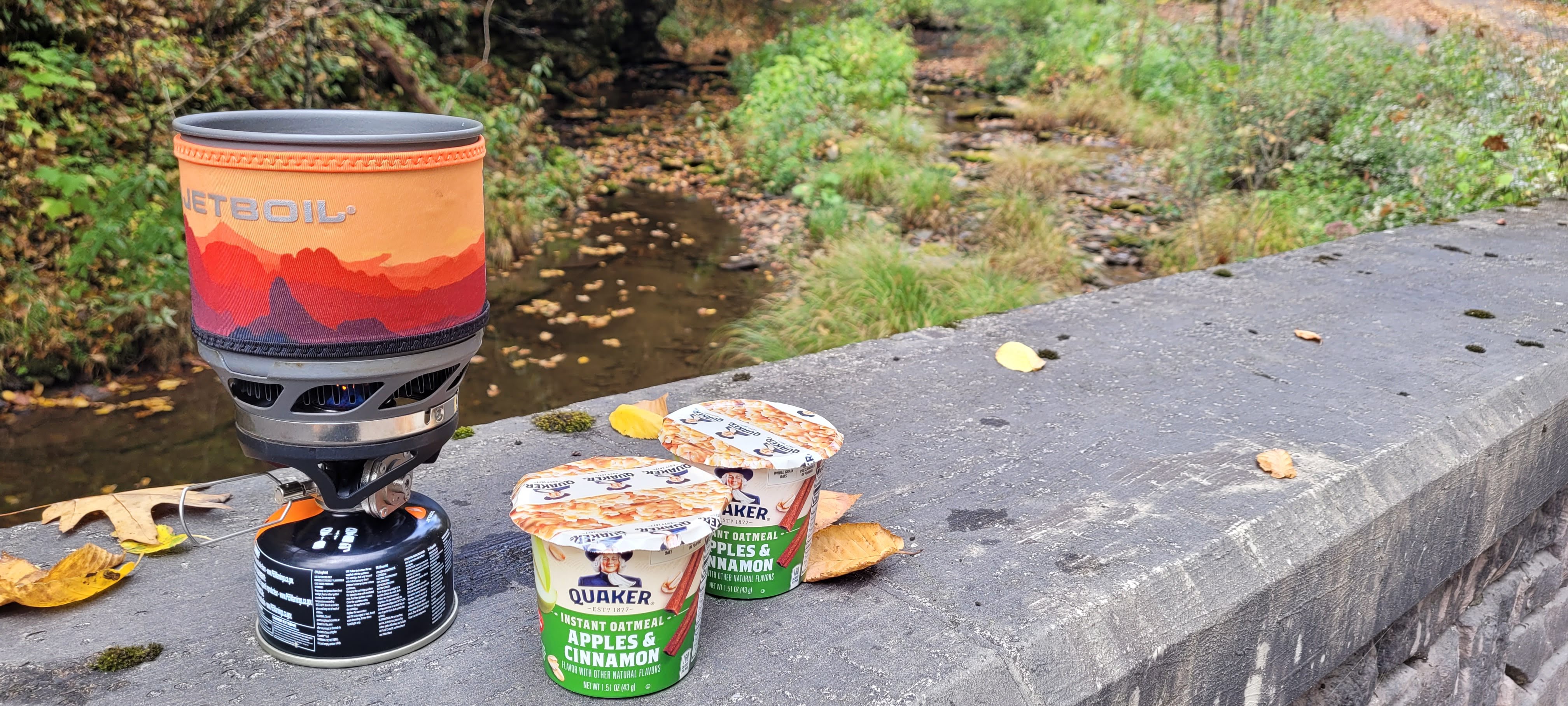
Waking up on Saturday morning, Chris and I stick to our usual breakfast of oatmeal, knowing we will be out riding for hours before there is any chance of lunch. It feels practical and responsible.
When we pull into the Moto Ranch, we are immediately greeted with enthusiastic pointing toward the white tent. Breakfast burritos from Grumpy’s are laid out for everyone. Even as I insist I am not that hungry I still walk towards the tent. I grab one because it’s impolite to turn down offered food, right?
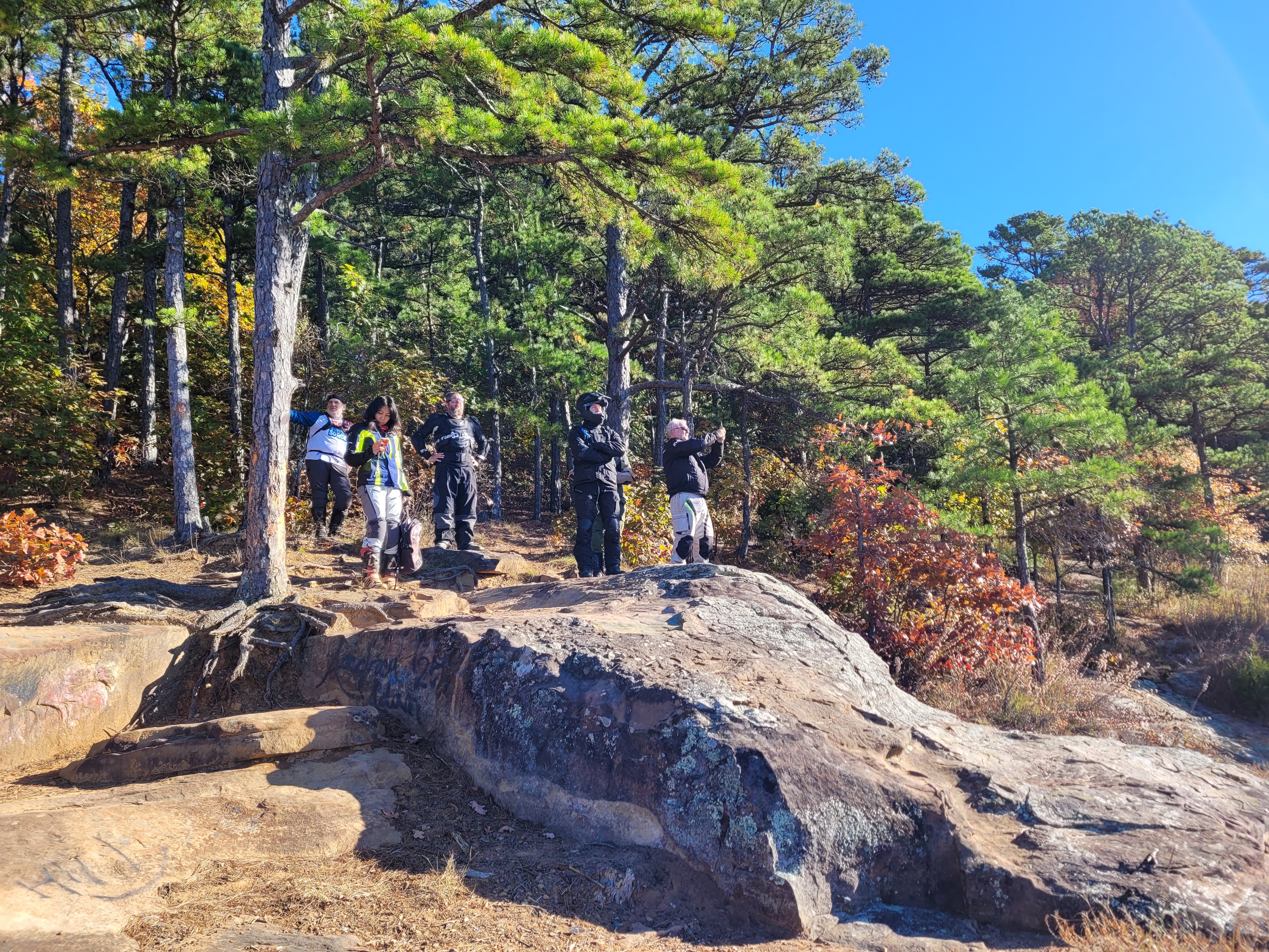
At 8:30 AM sharp, I roll out for the beginner guided group ride, with a planned pit stop at the Strawberry Bluffs viewpoint.
Chris has gone off with a group of more experienced riders. Before our group leaves the Moto Ranch, I watch them disappear in a cloud of dust and feel genuinely glad he gets the chance to let the throttle loose a bit more than he does when riding with me.
The sound of our ten bikes starting up at once carries differently than when it’s just the two of us heading out alone. There is an energy to it. A sense of shared momentum.
The gravel roads begin almost immediately. They wind and dip through the folds of the Ozark Mountains, climbing gently before dropping into shaded hollows. Although Chris and I never ride particularly fast while exploring on our own, there is something about being in a larger group that subtly shifts the pace. It’s rhythmic. Corners flow into one another. Dust hangs briefly in the morning light before settling back onto the road.
Joining a guided group ride with riders at a similar skill level turns out to be pure joy. There is comfort in knowing everyone is reading the terrain the same way, choosing similar lines, trusting the same pace. No pressure to prove anything. No anxiety about holding anyone back.
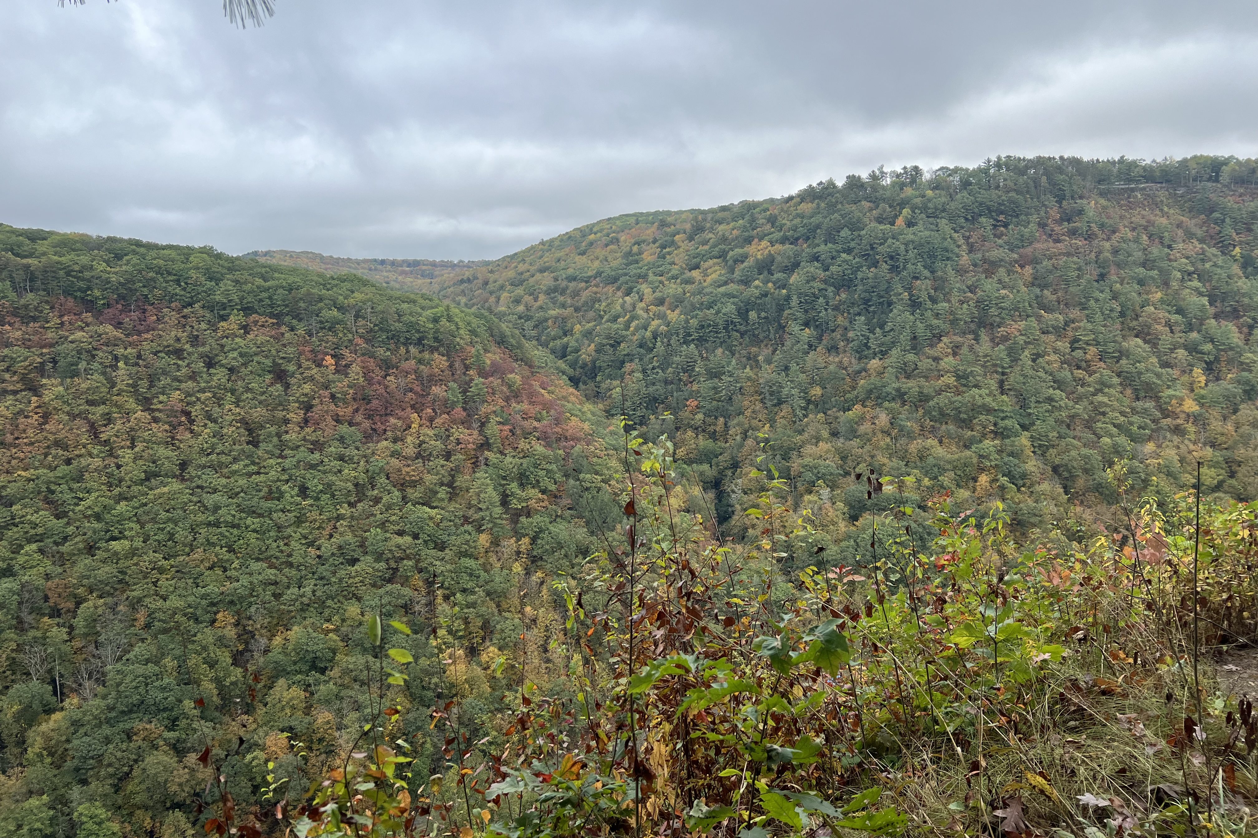
The Ozarks continue to surprise me. At Strawberry Bluffs, the overlook opens wide. You can see the patchwork of fields and forest below, the subtle blue haze softening the distant ridgelines.
Our group rolls into Hagarville Grocery & Deli sometime late in the morning. Inside, the small deli counter hums with the quiet rhythm of a family-run operation. I’m told that the local delicacy is a sandwich called Lipstick on a Pig. I don’t ask questions. I don’t need clarification.
Now, context is important here. This is technically my third full meal of the morning. We had our light breakfast, then the surprise burritos, and somehow I’ve found myself here, circling another counter. I am not hungry. Not even remotely.
What arrives is no dainty snack. It’s a substantial, warm sandwich wrapped in paper that barely contains it. Fried bologna, edges curled and crisped from the griddle. Melted cheese binding everything together. A soft, homemade bun that somehow holds its own against the grease and glory of it all. It’s unapologetic. It’s perfect.
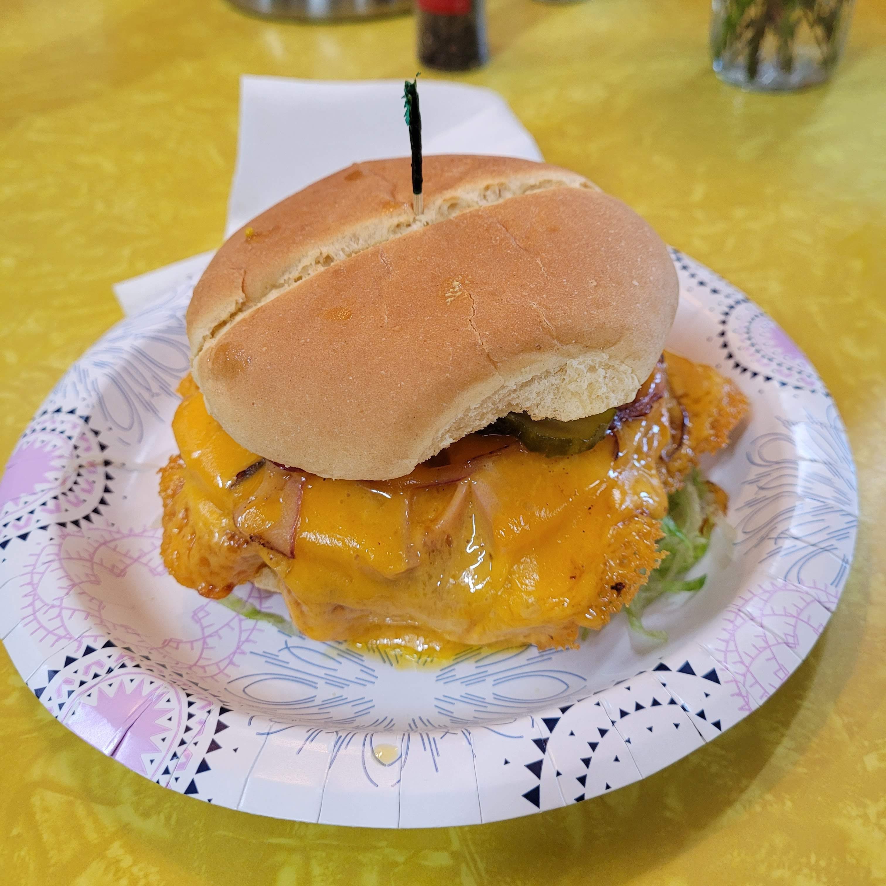
The first bite confirms it: this is comfort food in its purest form. Despite the very real threat of slipping into a carb-induced stupor, I eat the entire thing. Slowly at first, then with growing determination. Each bite feels like both a victory and a mild act of self-sabotage. By the end, I’m operating at that dangerous edge where one more bite could tip me into a full-blown food coma.
And yet, no regrets.
We roll back into camp just before noon. There is a short reset before the second guided ride heads out at 12:30. This time Chris has signed up, eager for another loop into the folds of the Ozark Mountains.
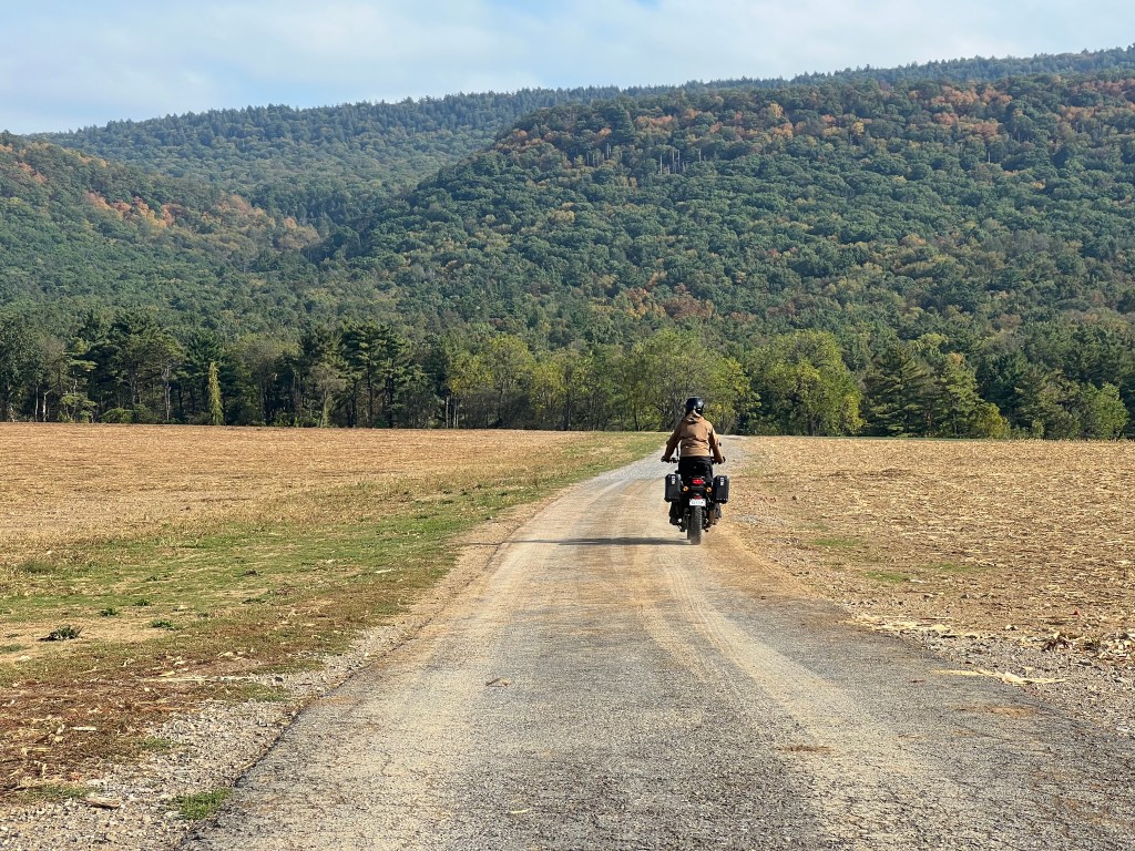
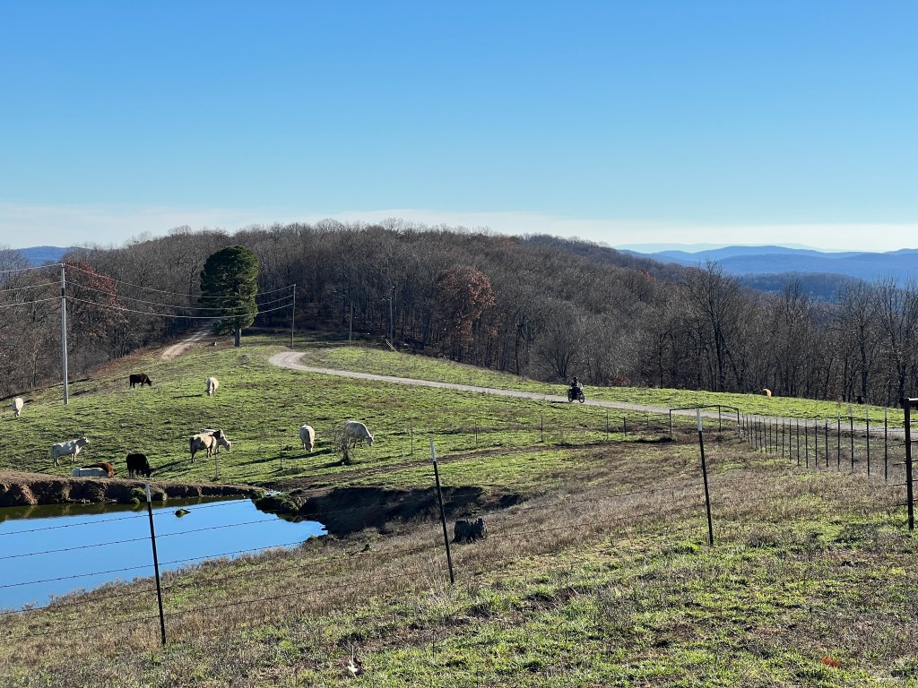
The afternoon ride feels softer somehow. We slip back onto forested roads that tunnel through hardwoods and pine, light flickering across visors in rhythmic flashes. One minute we are enveloped in dense woodland, the next we are skirting the edges of wide, open farmland. Expansive fields stretch out beside us, barns weathered, cattle grazing within sight. It feels almost like passing through someone’s backyard, intimate and unfiltered.
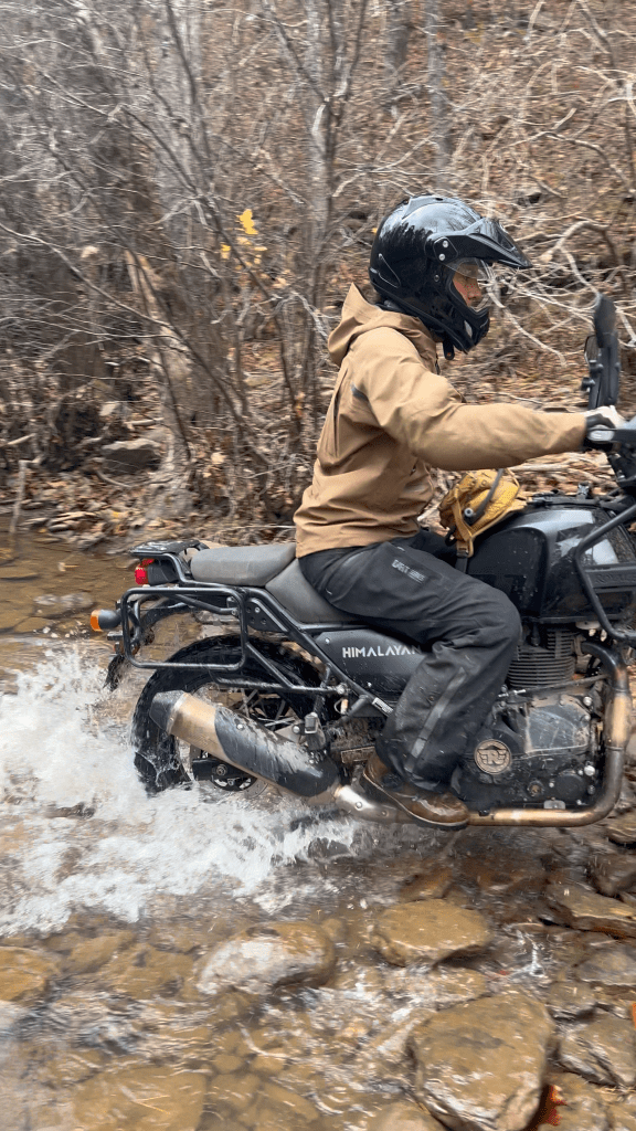
As the miles tick by, puddles begin to collect in the shaded sections of road. They are mostly shallow and friendly, their bottoms visible through murky colored water. Each crossing becomes a quiet lesson in commitment. Steady throttle. Light hands. Eyes up. Trust that whatever lies beneath the water will not deflect you if your body stays loose and your mind stays calm.
Then, just as we roll off the final stretch of gravel and queue up at a stop sign to rejoin the pavement back to the Moto Ranch, the unexpected happens.
Our guide, Bryan, has a low speed mishap. His Honda Africa Twin tips over in exactly the wrong position. The impact is minor, but the angle is not. Within seconds, oil begins to leak onto the road. A collective pause.
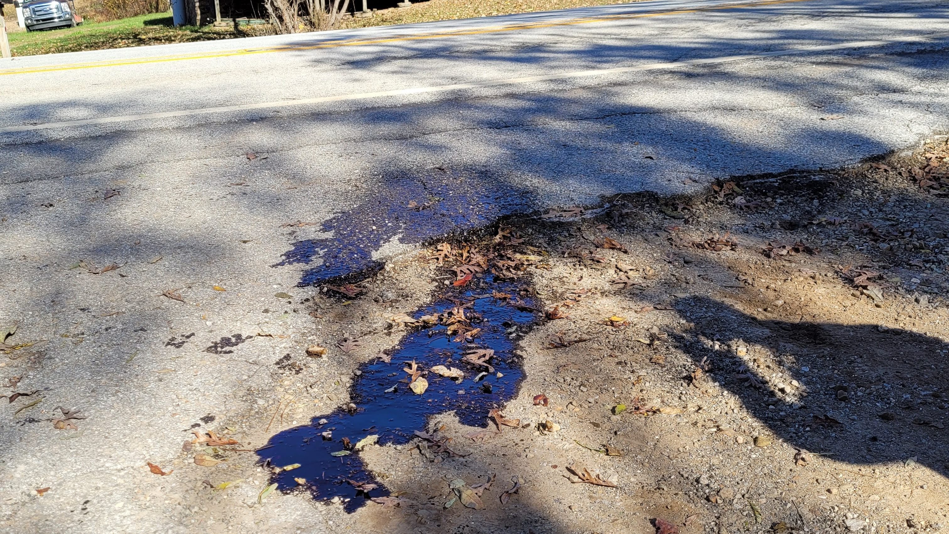
There is no riding that bike back.
Phones come out. Reinforcements are called. While we wait, the mood shifts from concern to problem solving. Chris happens to be one of the few riders with a GPS with the return track loaded. Just like that, he is promoted to guide. We remount and follow him back toward camp, the group stretching into a tidy line on the pavement. It feels oddly empowering to navigate ourselves home. When we pull in, the evening skill contests are already beginning. Not long after, Bryan and his wounded Africa Twin return in the bed of Dustin’s pickup truck, greeted with sympathetic applause and a few good natured jokes.
The Saturday evening events are the centerpiece of the weekend activities. First up: Fun for All Skills Competition. Think of it as a contained obstacle course designed to expose your skills and weaknesses on your motorcycle.
Riders begin by climbing the teeter tot hill, balancing their weight carefully before rolling down to kick a giant red ball positioned at the base. From there, they weave into a cone maze reminiscent of a GS Garage drill. Three tight S shaped sections demand precision. Drift outside the cones and penalty points stack up quickly.
Next comes the opposite side of the teeter tot, where a limbo pole waits. Riders must duck low while maintaining forward momentum, then climb a short hill to bump a barrel perched at the top. It has to roll down in a straight line, which means that positioning and controlled speed are everything.
The course does not let up. A tennis ball balanced on a PVC pipe must be grabbed on the move. Riders turn back toward the red ball they kicked earlier and attempt to throw the tennis ball onto it. Accuracy under pressure is harder than it sounds. The final task appears simple but rarely is. A track stand. Three full seconds of complete stillness before crossing the line.
Cheers erupt for the single clean run of the night: Lee! Groans follow missed throws and wobbly track stands. It is competitive, but playful. Skillful, but accessible.
Then comes the Best of the Ozarks ADV Skills Challenge.
This one raises the stakes.
Riders launch into a cone section before disappearing into the woods. They weave tightly through trees, climb onto a log bridge known affectionately as Logzilla, and continue into a rocky forested section that looks like it was curated by the terrain itself. Embedded stones, uneven ruts, off camber roots. The objective is simple to state and difficult to achieve. Get through with the fewest foot dabs possible.
The advanced riders make it look almost effortless. Controlled clutch work. Precise body positioning. Eyes always scanning two obstacles ahead.
Equally impressive is Kate, running between the start and finish lines with her GoPro, capturing footage from every possible angle. She sprints as hard as the riders ride, documenting each success and each near save.
By the end of the evening, the Ozarks have once again made their point. Speed is fun. Obstacles are humbling. Community makes all of it better. And every rider, no matter their level, leaves having learned something.
Moto Ranch Adventure Training: A personal Anthem On Getting This Far
Story time, because this might explain how I ended up here.
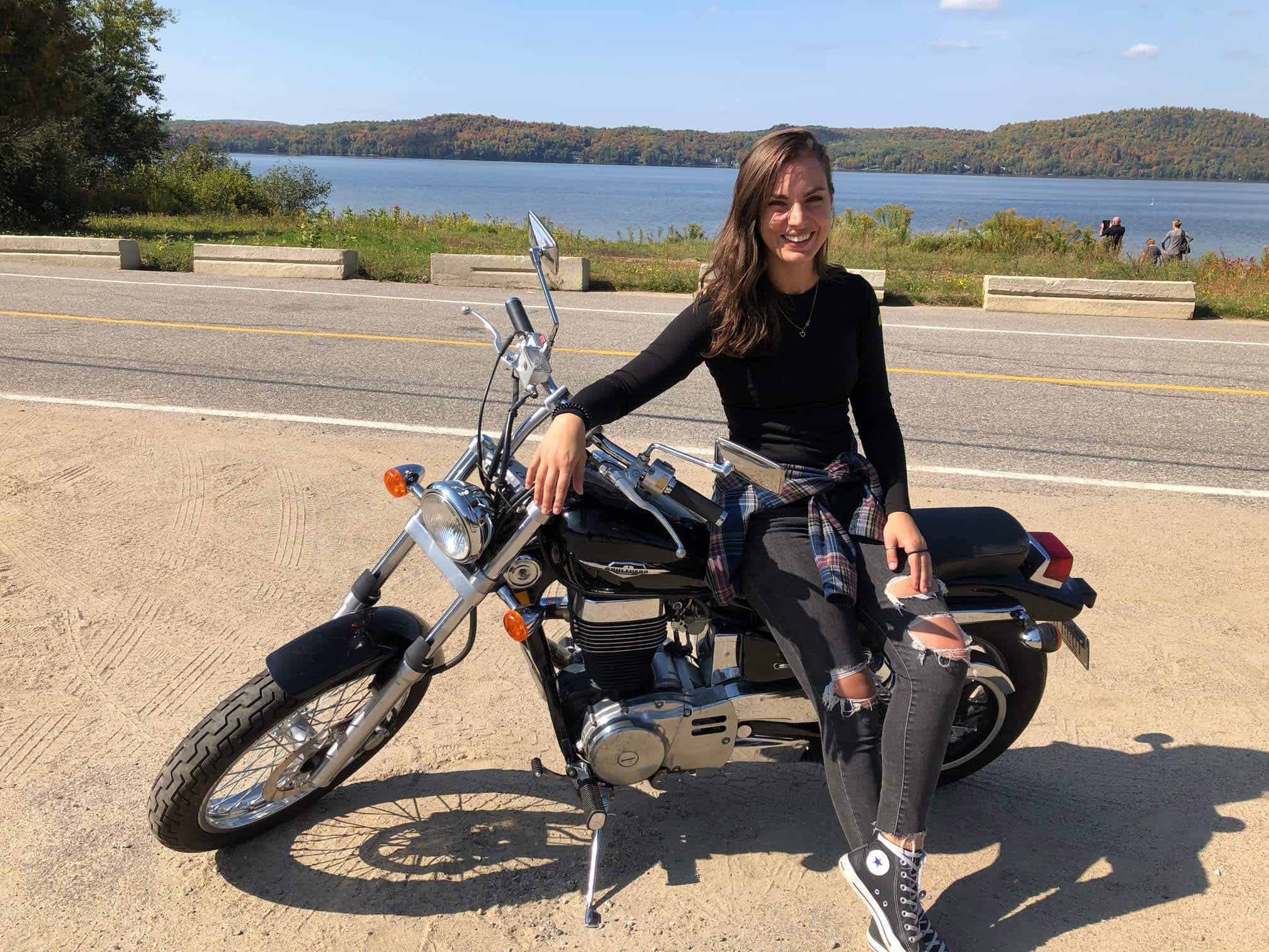
After six years on a perfectly unintimidating Suzuki Boulevard S40, I decided in 2023 that it was time for something different. I bought a Royal Enfield Himalayan. A 411cc single cylinder tractor of a motorcycle that immediately dragged me into an entirely new set of comfort zones. I named her Murphy. As in Murphy’s Law3. It felt realistic.
If I’m honest, I sometimes miss when paved, winding roads were the only plan. Back when the hardest decision on a ride was which scenic pull off deserved a photo and whether I wanted coffee before or after the twisties. Life was simple. Predictable. Upright.
Owning an adventure bike with zero off road background is sobering in a very public way. I spend a surprising amount of time explaining that yes, I drop my motorcycle. Fairly often. I am actually quite skilled at it. Keeping it upright is still a developing talent.
Somewhere along the way, downplaying my abilities became a coping mechanism. It is easier to make the joke first than to admit the imposter syndrome that creeps in when I ride with people who make technical terrain look effortless. You know the riders. Balanced. Relaxed. No visible panic. Meanwhile, I am internally negotiating with every rock and rut while pretending my dramatic foot dab was all part of the plan.
But also, and this is the important part, the places this motorcycle takes me are worth every awkward stall and tip over.
An adventure bike changes what feels possible. Dirt roads stop being questionable decisions. Forest trails stop being barriers. Forgotten back ways that most travelers never see suddenly feel like invitations. The discomfort expands your world.
And I would be lying if I did not give credit where it is due. Chris talks me through climbs and descents over our comm system with a calm I barely ever possess. When a section pushes past my current ability, he rides my bike through it without making it feel like a failure. Then he hands it back and tells me to try the next one.
We all grow differently. I just so happen to have chosen a slightly more demanding way.
The “How To Fall” Chronicles
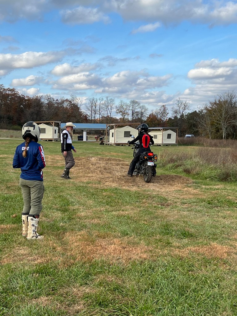
After the Arkansas Adventure Fall Rally weekend, I knew I had so much learning to do. I signed us up for a training session with Kate and Dustin at the Moto Ranch. Chris agreed that brushing up on slow-speed skills would be good for him too, and that it would be a fun thing to experience together. Understatement of the year. That afternoon turned out to be one of the most valuable riding experiences we’ve had so far.
The course focused on foundational adventure riding skills. The kind that quietly save you from dropping your bike in slow, humiliating ways. We practiced balance, control, and confidence through a series of thoughtfully designed drills. One of the first lessons centered around foot positioning when stopping, affectionately referred to as “dabbing.” Turns out, where and how you place your foot matters far more than I’d ever realized, especially when the ground isn’t flat, dry, or particularly cooperative. This would have been lovely to know in the Fist Fight trail a few days ago, but I digress.
From there, we worked on slow speed, clutch control, balance, multitasking by riding in first gear while picking up a tennis ball and delivering it to the next PVC platform. One deceptively simple exercise. We practiced emergency braking, learning how to stop quickly and effectively without panic-grabbing the front brake and immediately regretting it.
There were controlled climbs up and down a high dirt mound, emphasizing body position and momentum. We rode through ruts without fighting the bike, practiced full-lock 180-degree turns between cones that gradually moved closer together, and learned how to trust the motorcycle to do what it was designed to do, provided we weren’t actively sabotaging it (Who would have thought?).
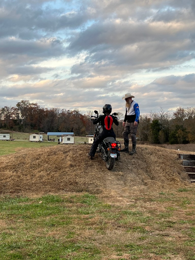
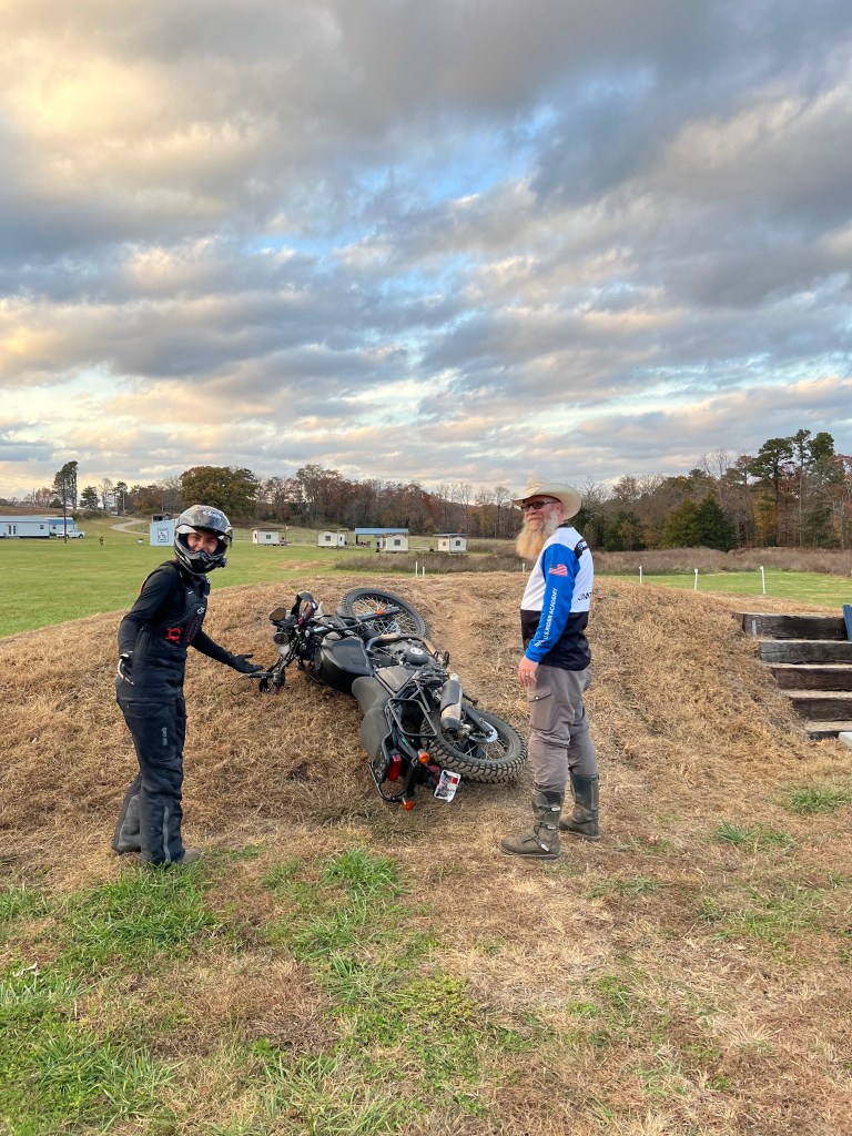
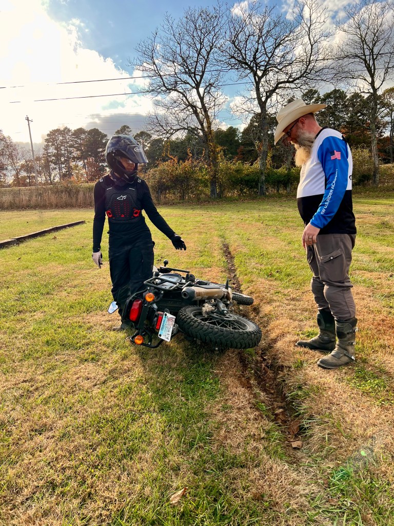
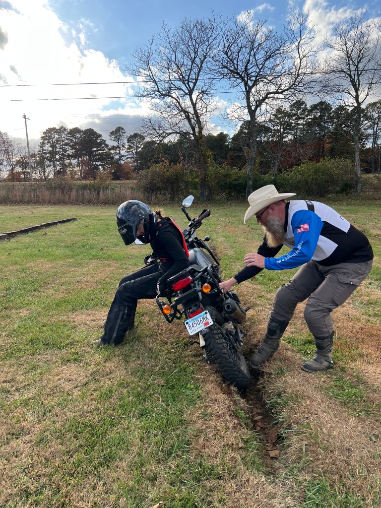
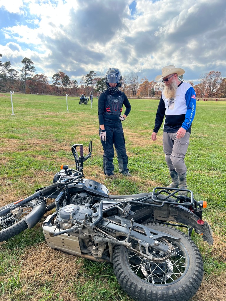
Another monumental win for my confidence was learning how to pick up my motorcycle by myself. Up until this point, I had never really attempted to lift the 400 lb machine without Chris’ help, so being able to lift it correctly felt like a huge accomplishment in my learning curve.
By the end of the session, everything felt more intentional. Less reactive. The fear didn’t disappear, but it quieted down, replaced by understanding and muscle memory. The kind that gently nudges you toward better decisions.
I left the ranch tired, dusty, and grinning. Still learning. Still falling sometimes. But now, with a few more tools in the toolbox, and a little less reason to doubt that I belong out there at all.
Water Crossings: A Foot Dabbing Memoir
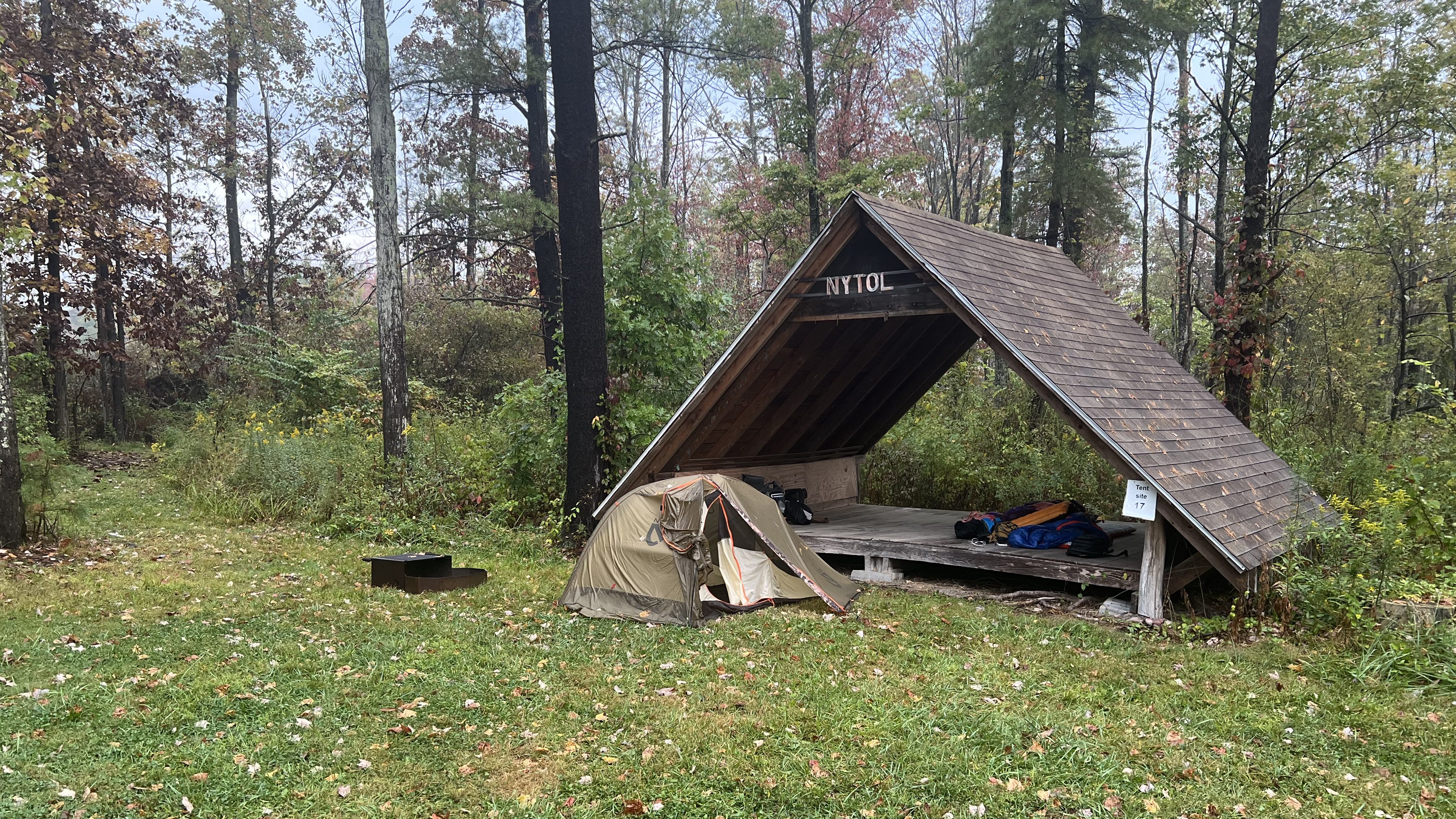
At our campground, we met Brett and Nicole, who had just moved to Arkansas from Florida. Brett rode a small dirt bike and was eager to find people to explore with him while they got to know the area. One Saturday afternoon, Chris, Brett, and I headed out for what we thought would be a short, easy ride.
It did not turn out that way.
Rain from the night before had transformed the trails. Clay turned slick, ruts deepened, and sections that might have been simple on a dry day suddenly felt far more technical than I had wanted to tackle. We pressed on carefully. At one particularly steep, slippery descent scattered with large boulders, Chris rode my bike down for me while I walked it. No ego, just teamwork.
Then came the water crossings.
We rode through more river beds that afternoon than I ever had before. Most were shallow, but deep enough that when I dabbed, my foot and ankle disappeared under water. One crossing stretched long and wide, and I could feel the nerves creeping in.
Instead of focusing on the far bank, I remembered my training. Pick a point. In this case, a rock sticking out of the water. Ride to it. Stop. Regroup. Choose the next one. I repeated that process three times, steadying my breath and committing to each small section instead of the whole intimidating span.
And then I was across.
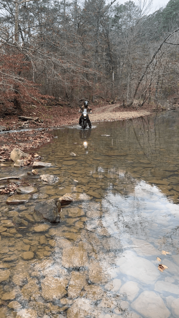
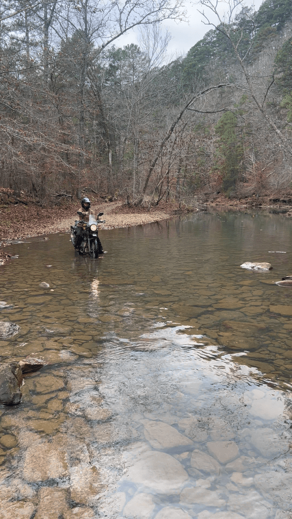
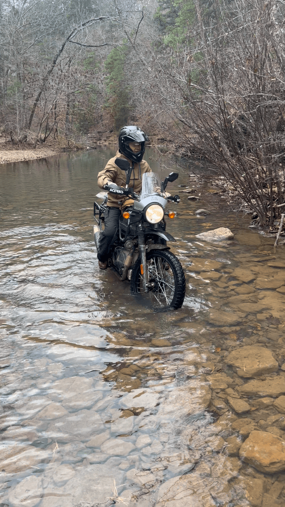
It was not dramatic. But it felt amazing hearing Chris and Brett cheering about my success. What had felt challenging only hours earlier already sounded like the beginning of a good memory.
The next evening, the four of us gathered around the campfire. Stories flowed easier than the river had the day before. This is one of my favorite parts of living on the road, meeting new people we can connect and become friends with.
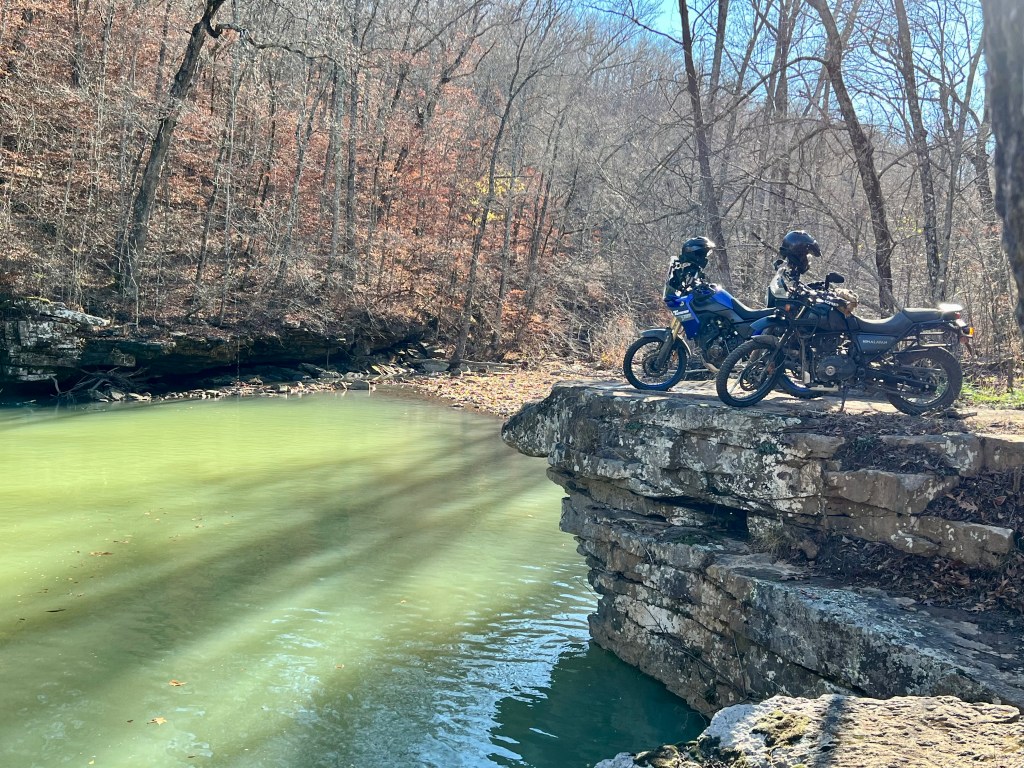
Honorable Mention To The Boston Blue Hole
Reaching the Boston Blue Hole feels like earning a secret.
The route there is not glamorous. At one point, it leads us straight through an open cow pasture, the kind with no clear boundary between “public road” and “someone’s backyard.” Cattle scatter lazily as we idle past, every head lifting in synchronized suspicion. One massive bull stands apart from the herd, watching us with slow, deliberate focus. For a brief moment, it feels less like a scenic detour and more like a negotiation. We keep our speed steady, respectful, hoping he decides we are not worth the trouble.
And then, just beyond the field, the landscape shifts.
The Boston Blue Hole sits tucked into the Ozark forest near the community of Boston in northwest Arkansas. Fed by a cold spring and surrounded by limestone bluffs, the pool is known for its striking, almost unreal color. The water is not simply blue. It is milky, luminous, almost unreal against the green canopy overhead.
That distinct turquoise hue comes from the geology that defines the Ozark Mountains. Sunlight reflects off microscopic calcium carbonate crystals suspended in the water, a byproduct of dissolved limestone filtering through the region’s karst landscape. The result is a soft, opaque blue that seems to glow from within, especially when the light hits it at the right angle.
Our time in Arkansas has come to an end, and somehow I already feel nostalgic. It has easily become one of my favorite destinations to date. Writing this chapter took longer than I expected2 because I wanted to do it justice, to capture the texture of the trails, the color of the water, and the feeling of riding through hills that constantly surprised me. More than the landscapes, though, it is the people who defined this stop. The friendships formed around campfires, the invitations into homes, the shared rides and shared meals gave us something we had quietly been missing on the road. In Arkansas, we did not just pass through. We belonged.
Notes:
- Kate & Dustin: Just incredible human beings, that became friends over the course of our month in Arkansas. Thank you for welcoming us into your home and shared your passion for adventure riding.
- This article took way longer than anticipated to write because of my perfectionism. We had such a blast here, that redundancy wasn’t an option here.
- Wikipedia Definition of Murphy’s law is an adage or epigram that is typically stated as: “Anything that can go wrong will go wrong.”